| Topography | ||
|
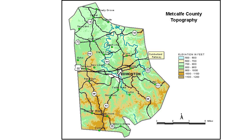
Discussion from McGrain and Currens (1978) Metcalfe
County is in the Mississippian Plateaus Region of south-central
Kentucky. The northwestern part of the county contains a karst topography
with abundant sinkholes, but most of Metcalfe County is a well-dissected,
rolling to hilly, upland plateau. The sinkhole plain has elevations
between 750 and 800 feet. The lowest elevation, 560 feet, is on the Little Barren River where
it leaves the northern part of the county. Edmonton, the county seat, is 843 feet. Other elevations include Center, 806 feet; Knob Lick, 755 feet; Randolph, 945 feet; Sulphur Well, 612 feet; and Summer Shade, 877 feet. The 7.5-minute topographic quadrangle maps that cover Metcalfe County
are shown, by name and by index code (Kentucky Natural Resources and
Environmental Protection Cabinet) on the index
map. Previous--Next--Back to "Groundwater Resources in Kentucky"
|
||