| Topography | ||
|
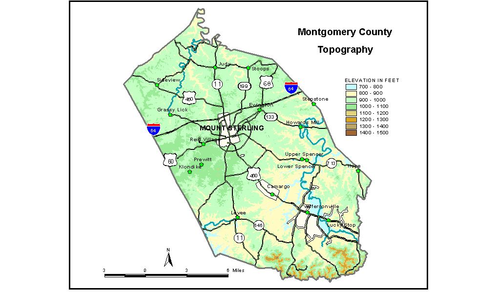
Discussion from McGrain and Currens (1978) Most of Montgomery
County lies in the Outer Bluegrass Region of central Kentucky. The
eastern and southern edges of the county border the Eastern Kentucky
Coal Field and contain a number of high knobs and ridges, many with
elevations in excess of 1,200 feet. The highest elevations in the county
are found there. The elevation of Slate Creek where it crosses the Montgomery-Bath County
line is about 730 feet, and the elevation of Hinkston Creek where it
leaves the county is about 800 feet. Ridgetop elevations over most of
the county range between 1,000 and 1,100 feet. For the most part, the
terrain is rolling to hilly, but there are a number of low, broad, flat-topped
ridges in the Camargo-Jeffersonville area of southeastern Montgomery
County and a few high, flat-topped ridges adjacent to Slate Creek south
of Howards Mill in the east-central part of the county. Elevations of general interest include Mount Sterling, at the courthouse, 970 feet; Camargo, 925 feet; Howards Mill, 775 feet; Jeffersonville, 842 feet; Judy, 1,008 feet; Sid Calk Lake, 925 feet; Greenbrier Creek Reservoir, 805 feet; and the lake at Camp McKee, 860 feet. The 7.5-minute topographic quadrangle maps that cover Montgomery County
are shown, by name and by index code (Kentucky Natural Resources and
Environmental Protection Cabinet) on the index
map. Previous--Next--Back to "Groundwater Resources in Kentucky"
|
||