| Topography | ||
|
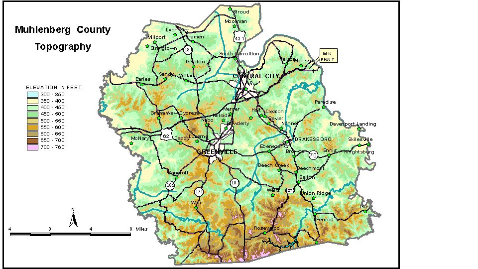
Discussion from McGrain and Currens (1978) Muhlenberg
County is in the Western Kentucky Coal Field. It is a well-dissected
upland area with ridgetop elevations ranging from 700 feet in the south
to 500 feet in the north. The topography near the southern edge of the
county is more rugged than in other parts of the area. Valley sides
are steep, and some have nearly vertical cliffs. Local relief may be
as great as 200 feet. The upland areas between the valleys may be nearly
level. In the central and northern parts of the county, hills are not
as steep, and the relief is not as great. The highest elevation in the county, 760 feet, is on a ridge about 1.5 miles west of Rosewood in the southern part of the county. A ridge at the eastern edge of Dunmore has an elevation of 730 feet, and Welburn Ridge near the southeastern corner of the county is 701 feet. The elevation of Greenville, at the courthouse, is 538 feet. Other elevations include Beech Creek, at the railroad, 450 feet; Beechmont, 495 feet; Belton, 427 feet; Bremen, 460 feet; Browder, 425 feet; Central City, 430 feet; Cleaton, 450 feet; Depoy, 498 feet; Drakesboro, 440 feet; Dunmore, 589 feet; Graham, 460 feet; Luzerne, 470 feet; Martwick, 490 feet; Millport, 409 feet; Moorman, 421 feet; Paradise, 407 feet; Powderly, 450 feet; Rosewood, 602 feet; and Weir, 629 feet. The elevation of Lake Malone is 450 feet. The 7.5-minute topographic quadrangle maps that cover Muhlenberg County
are shown, by name and by index code (Kentucky Natural Resources and
Environmental Protection Cabinet) on the index
map. Previous--Next--Back to "Groundwater Resources in Kentucky"
|
||