| Topography | ||
|
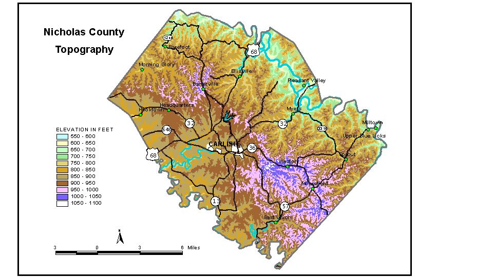
Discussion from McGrain and Currens (1978) Nicholas
County is in the Outer Bluegrass Region of central Kentucky. The
terrain is rolling to hilly with moderate local relief. The greatest
local relief is along the valley of Licking River, which marks the northern
boundary of the county. Here differences in elevation between the valley
floor and the adjacent upland ridges may be as great as 200 to 250 feet.
The lowest elevation in the county, approximately 565 feet, is the point
where Licking River leaves the county. The elevation of Carlisle, the county seat, is 879 feet. Moorefield
is at an elevation of 985 feet, and Barterville is at 1,000 feet. The 7.5-minute topographic quadrangle maps that cover Nicholas County
are shown, by name and by index code (Kentucky Natural Resources and
Environmental Protection Cabinet) on the
index map. Previous--Next--Back to "Groundwater Resources in Kentucky"
|
||