| Topography | ||
|
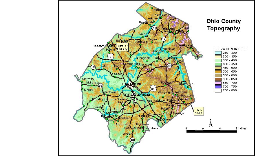
Discussion from McGrain and Currens (1978) Ohio
County is in the Western Kentucky Coal Field. It is primarily a
terrain of rolling hills with local reliefs up to 150 feet. The elevation of Hartford, the county seat, is 428 feet. Other elevations
are Aetnaville, 487 feet; Beaver Dam, 414 feet; Centerton, 424 feet;
Cromwell, 461 feet; Dundee, 420 feet; Fordsville, 468 feet; McHenry,
420 feet; Olaton, 450 feet; Pleasant Ridge, on the Ohio-Daviess County
line, 522 feet; Render, 421 feet; and Rosine, 564 feet. The 7.5-minute topographic quadrangle maps that cover Ohio County are
shown, by name and by index code (Kentucky Natural Resources and Environmental
Protection Cabinet) on the index
map. Previous--Next--Back to "Groundwater Resources in Kentucky"
|
||