| Topography | ||
|
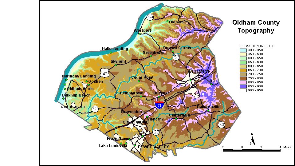
Discussion from McGrain and Currens (1978) Oldham
County is in the Outer Bluegrass Region of north-central Kentucky.
The Ohio River marks the northwestern border, and the normal pool elevation
of the Ohio River, 420 feet, is the lowest elevation in the county.
Adjacent bluffs rise abruptly 200 to 350 feet above the river or narrow
floodplain and mark the sites of the greatest local relief. The eastern edge of the county is more highly dissected by normal stream
erosion and is noticeably hilly. A few ridges are flat topped. The width
of the ridges increases to the west. In the vicinity of the western
edge of the county, wide expanses of gently rolling to nearly flat land
are present. Here, local relief is slight, except near Floyds Fork and
Harrods Creek, which have carved valleys 150 to 200 feet below the surrounding
upland. The elevation of LaGrange, the county seat, is 867 feet. Other elevations
include Ballardsville, 860 feet; Brownsboro, 721 feet; Buckner, 831
feet; Crestwood, 798 feet; Skylight, 730 feet; and Westport, 486 feet.
The elevation of Crystal Lake, southeast of LaGrange, is 777 feet. The 7.5-minute topographic quadrangle maps that cover Oldham County
are shown, by name and by index code (Kentucky Natural Resources and
Environmental Protection Cabinet) on the index
map. Previous--Next--Back to "Groundwater Resources in Kentucky"
|
||