| Topography | ||
|
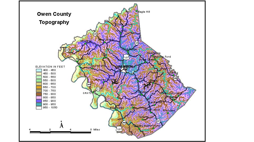
Discussion from McGrain and Currens (1978) Owen
County is in the Outer Bluegrass Region of north-central Kentucky.
The Kentucky River marks the western boundary, and Eagle Creek marks
the northern boundary. The area is a well-dissected upland, and the
topography is definitely hilly. Local relief ranges from approximately
100 feet in headwater areas to more than 350 feet along the bluffs of
the Kentucky River and Eagle Creek. Principal areas of flat land are
in the valleys of these two streams, and the lowest elevation in the
county, approximately 425 feet, is at their confluence at the northwestern
corner of the county. The 7.5-minute topographic quadrangle maps that cover Owen County are
shown, by name and by index code (Kentucky Natural Resources and Environmental
Protection Cabinet) on the index
map. Previous--Next--Back to "Groundwater Resources in Kentucky"
|
||