| Topography | ||
|
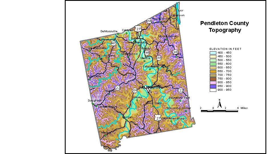
Discussion from McGrain and Currens (1978) Pendleton County is in the Outer Bluegrass Region of northern Kentucky. The terrain is rolling to hilly. The Licking River, which crosses the county in broad, meandering loops 100 to 200 feet below the upland, is the most striking feature of the county. Practically the only flat areas in the county are found in the valley bottom. The elevation of Licking River where it leaves the county at DeMossville is approximately 470 feet. The lowest elevation in the county is 455 feet, the normal pool level of the Ohio River in the vicinity of Carntown. In this area, the ridgetops are more than 360 feet above the river. There is very little floodplain area along the Ohio in Pendleton County. Ridgetop elevations are commonly 800 to 900 feet. The highest elevation in the county, 960 feet, is on a ridge adjacent to Ky. 22 near the Pendleton-Bracken County line. The elevation of Falmouth, the county seat, is 558 feet. Elevations at other communities are Butler, 540 feet; DeMossville, 521 feet; and Gardnersville, 882 feet. The 7.5-minute topographic quadrangle maps that cover the county are shown, by name and by index code (Kentucky Natural Resources and Environmental Protection Cabinet) on the index map. Previous--Next--Back to "Groundwater Resources in Kentucky"
|
||