| Topography | ||
|
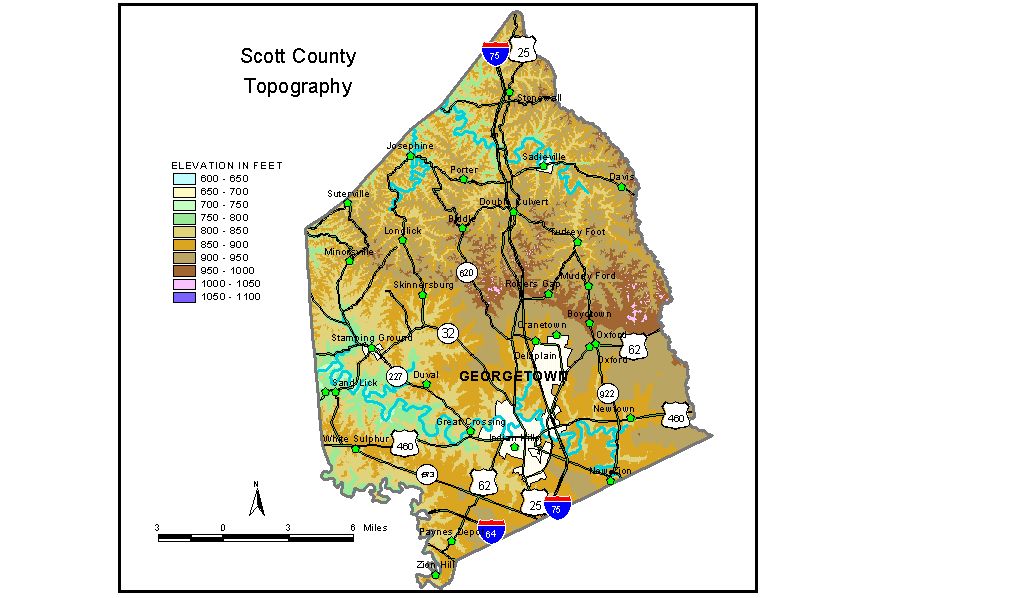
Discussion from McGrain and Currens (1978) Scott County covers parts of both the Inner and Outer Bluegrass Regions of central Kentucky. The topography ranges from gently rolling to hilly. Local relief is generally less than 100 feet in the southern part of the county, but 100 feet or more in the northern part. The greatest local reliefs are in the vicinity of Eagle Creek, where differences in elevation between the stream and the adjacent upland exceed 140 feet. Ridgetop elevations generally range between 900 and 1,000 feet. The highest elevation in the county, 1,060 feet, is on a ridge on the Scott-Harrison County line, 1 mile west of Leesburg (Harrison County). This ridge is also part of the drainage divide between the Kentucky and Licking Rivers. The lowest elevation in the county, about 690 feet, is the point where North Elkhorn Creek leaves the county. Eagle Creek leaves the county at an elevation of approximately 715 feet. The elevation of Georgetown, the county seat, is 840 feet. Elevations at other communities are Delaplain, 880 feet; Great Crossing, 800 feet; Newtown, 861 feet; Paynes Depot, 845 feet; and Sadieville, 858 feet. The 7.5-minute topographic quadrangle maps that cover the county are shown, by name and by index code (Kentucky Natural Resources and Environmental Protection Cabinet) on the index map. Previous--Next--Back to "Groundwater Resources in Kentucky"
|
||