| Topography | ||
|
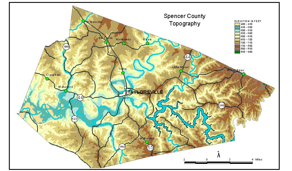
Discussion from McGrain and Currens (1978) Spencer County, in the Outer Bluegrass Region, is characterized by a rolling to hilly topography. Local reliefs of 100 to 150 feet are common, but the Salt River and its major tributaries have cut valleys 200 to 250 feet below the surrounding upland. Hilltop and ridgetop elevations range from 700 feet in the western part of the county to more than 800 feet in the eastern part. Slopes are rarely steep except close to major drainage lines, and flat areas can be found locally, both in valleys and on ridgetops. The highest elevation in the county, 880 feet, is on a ridge near the Spencer-Shelby County line, 2 miles southeast of Mount Eden. The lowest elevation, 420 feet, is the point where the Salt River leaves the western tip of the county. The elevation of Taylorsville, the county seat, is 490 feet. Other elevations are Little Mount, 758 feet; Mount Eden, on the Spencer-Shelby County line, 841 feet; Wakefield, 715 feet; and Waterford, 485 feet. The 7.5-minute topographic quadrangle maps that cover the county are shown, by name and by index code (Kentucky Natural Resources and Environmental Protection Cabinet) on the index map. Previous--Next--Back to "Groundwater Resources in Kentucky"
|
||