| Topography | ||
|
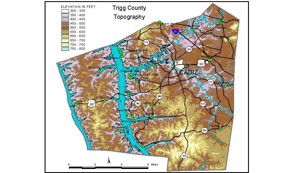
Discussion from McGrain and Currens (1978) Trigg County is located on the Kentucky-Tennessee state line in southwestern Kentucky. The topography of the eastern part of the county is typical of the Mississippian Plateaus Region. Sinkholes and features associated with underground drainage abound in this area. Scattered hills and ridges, capped with more resistant rocks, rise above the karst (sinkhole) plain. The highest elevation in the county, 813 feet, is on Buie Knob, 2 miles southeast of Cerulean Springs in the northeastern corner of the county. Other knobs in this area attain elevations in excess of 700 feet. The sinkhole plain immediately to the south is generally at elevations between 500 and 550 feet. The western and south-central parts of the county are areas of irregular hills and ridges. Ridgetop elevations in the south-central area range from 600 feet to more than 700 feet. Probably the most striking features of the Trigg County landscape are the two large, man-made lakes--Kentucky Lake along the western border of the county and Lake Barkley, which crosses west-central Trigg County from south to north. Both lakes have normal pool elevations of 359 feet, the lowest elevation in the county. The area west of Lake Barkley is part of the region called "The Land Between the Lakes." Highest hills and ridges here generally range from 500 to 600 feet. The elevation of Cadiz, at the courthouse, is 423 feet. Other elevations of interest are Caledonia, 455 feet; Canton, 450 feet; Cerulean Springs, 513 feet; Linton, 390 feet; and Roaring Spring, 550 feet. The 7.5-minute topographic quadrangle maps that cover the county are shown, by name and by index code (Kentucky Natural Resources and Environmental Protection Cabinet) on the index map. Previous--Next--Back to "Groundwater Resources in Kentucky"
|
||