| Topography | ||
|
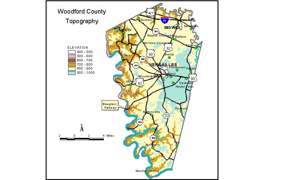
Discussion from McGrain and Currens (1978) Woodford County is in the western part of the Inner Bluegrass Region of central Kentucky. It is a gently to moderately rolling limestone upland with ridgetop elevations ranging from 950 feet in the east to 850 feet in the western part of the county. The tops of some ridges are almost flat. Karst features are locally conspicuous but do not dominate the landscape. The Kentucky River forms the western boundary of the county. The river has carved its valley 300 to 350 feet below the adjacent upland. Almost precipitous limestone bluffs line the valleys of the Kentucky River and the lower parts of some of its tributaries. Greatest local reliefs are found in these areas. The highest elevation in the county, 1,000 feet, is on a ridge north of Dry Ridge Pike, southeast of Versailles. The lowest elevation is 469 feet, the normal pool level of the Kentucky River where it leaves the county. The normal pool level of the Kentucky River upstream from Lock No. 5 is 483 feet. The elevation of Versailles, at the courthouse, is approximately 895 feet. Other elevations include Midway, 840 feet; Millville, 570 feet; Mortonville, 780 feet; Nugent Crossroads, 861 feet; and Nonesuch, 813 feet. The 7.5-minute topographic quadrangle maps that cover the county are shown, by name and by index code (Kentucky Natural Resources and Environmental Protection Cabinet) on the index map. Previous--Next--Back to "Groundwater Resources in Kentucky"
|
||