| Topography | ||
|
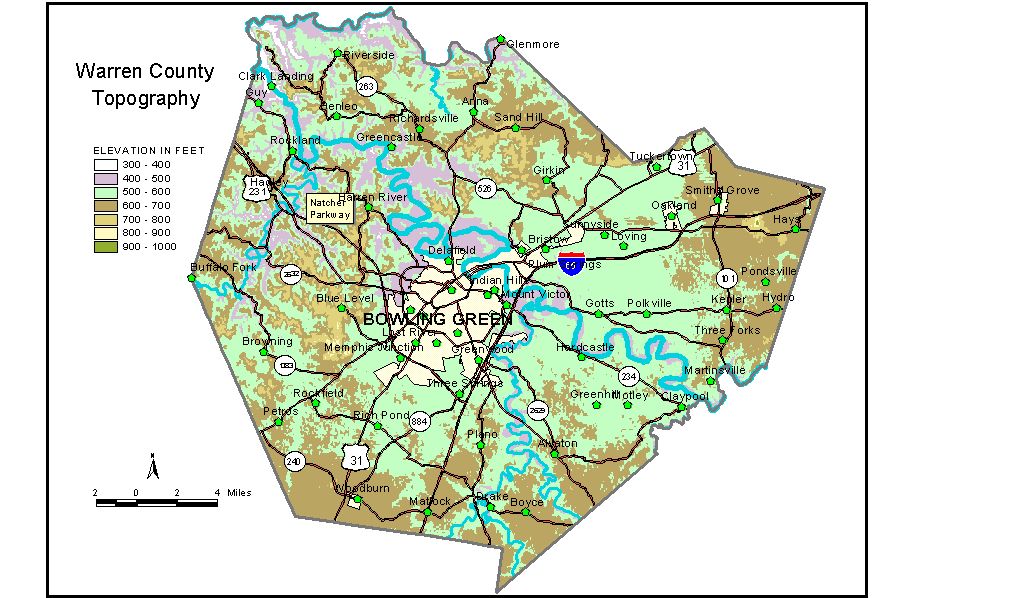
Discussion from McGrain and Currens (1978) Warren County is in the Mississippian Plateaus Region of southern Kentucky. Topographically, the county occupies parts of two plateau areas. The lower area is a slightly rolling, karst (sinkhole) plain characterized by few surface streams and hundreds of sinkholes. The elevations on the plain range from more than 650 feet in the southeast to approximately 500 feet in the vicinity of Bowling Green. A second, higher plateau lies to the northwest, separated from the sinkhole plain by the Dripping Springs Escarpment, a southeast-facing cuesta which traverses the county from northeast to southwest. The Dripping Springs Escarpment, rising approximately 200 feet above the sinkhole plain, is the most prominent topographic feature in the county. Elevations along the crest of the escarpment generally range from 700 to 750 feet. Locally, the Dripping Springs Escarpment has been referred to as "the knobs," but it should not be confused with the belt of knobs of Muldraugh Hill which is associated with a different group of rocks. The area north and west of the Dripping Springs Escarpment is more highly dissected by stream erosion than the lower karst plain and contains greater local differences in elevation. Local relief of 200 feet is common in this part of the county. The highest point in Warren County is Pilot Knob, an isolated hill about 2 miles southeast of Smiths Grove, with an elevation of approximately 955 feet. It towers more than 300 feet above Smiths Grove. The lowest elevation is approximately 395 feet, the elevation at the confluence of the Barren and Green Rivers in the northwestern corner of the county. The Green River marks the northern boundary of the county, and the Barren River crosses the full width of the county in a northwest direction. The elevation of Bowling Green at the courthouse is 510 feet, and the highest point on the Western Kentucky University campus is about 650 feet. Other elevations include Alvaton, 660 feet; Bristow, 540 feet; Drake, 587 feet; Hadley, 680 feet; Hardcastle, 569 feet; Hays, 672 feet; Oakland, 579 feet; Polksville, 568 feet; Rich Pond, 590 feet; Riverside, 550 feet; Rockfield, 590 feet; Smiths Grove, 630 feet; Woodburn, 638 feet; and the spillway at Shanty Hollow Lake, 439 feet. The 7.5-minute topographic quadrangle maps that cover the county are shown, by name and by index code (Kentucky Natural Resources and Environmental Protection Cabinet) on the index map. Previous--Next--Back to "Groundwater Resources in Kentucky"
|
||