| Topography | ||
|
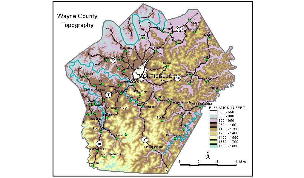
Discussion from McGrain and Currens (1978) Wayne County, in southern Kentucky, covers parts of both the Mississippian Plateaus and the Eastern Kentucky Coal Field physiographic regions. The Cumberland Escarpment, which traverses the county from southwest to northeast and separates the two physiographic regions, is the most conspicuous topographic feature. The western part of the county is a karst (sinkhole) plain with elevations generally ranging from 950 to 1,050 feet. Numerous hills, knobs, and other irregular land masses, all erosional remnants of the upland to the east, dot the lower plateau and rise as much as 500 to 600 feet above it. Morris Hill at 1,560 feet and Sulphur Spring Mountain at 1,540 feet, both just south of Monticello, are examples of these upland masses almost completely surrounded by the sinkhole region. Karst valleys indent the western edge of the escarpment, and surface waters flowing off the highlands may disappear into underground routes before reaching trunk streams. The Eastern Kentucky Coal Field portion of the county is a higher plateau area almost completely dissected by normal stream erosion. Precipitous cliffs rim many of the ridges, standing out in bold relief. Highest elevations are found on the western edge of the plateau and may be as great as 1,700 feet in the southwestern area. Brokedown Cliff at 1,700 feet and Round Cliff at 1,780 feet, south and southeast of Powersburg, are noticeable high points. Another ridge, located in the same area and 3/4 mile north of the Kentucky-Tennessee state line, has a recorded elevation of 1,788 feet, possibly the highest in the county. Lake Cumberland is along or near the northern boundary of Wayne County. The lowest elevation in the county, 723 feet, is the normal pool elevation of the lake. The elevation of Monticello, the county seat, is 923 feet. Other elevations include Coopersville, 861 feet; Frazer, 904 feet; Mill Springs, 844 feet; Parmleysville, 895 feet; and Powersburg, 916 feet. The 7.5-minute topographic quadrangle maps that cover the county are shown, by name and by index code (Kentucky Natural Resources and Environmental Protection Cabinet) on the index map. Previous--Next--Back to "Groundwater Resources in Kentucky"
|
||