
The Kentucky Geological Survey has archived this material, meaning (1) it is for reference, research, or recordkeeping; (2) it was created before April 24, 2026; (3) and the material has not been changed or altered since being archived. Please refer to our KGS Accessibility page for more information.
KGS Home > Geology of Kentucky
Celina West, TN
Location. Outcrop is located 3.75 miles (2.33 km) west of Celina, TN, Clay County, on TN 52.
Latitude/longitude: The first roadcut (panorama 1) is located at 36.58090 N., 85.55760 W on the Celina TN-KY 7.5-minute geologic quadrangle map. The map can be ordered from the Tennessee Division of Geology at www.state.tn.us/environment/tdg/
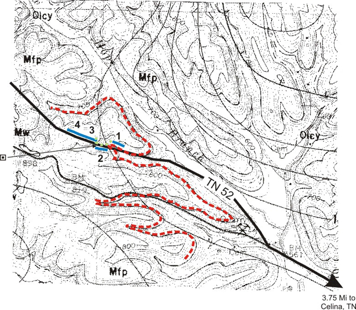
Figure 1. Location of the Celina West mound, Fort Payne Formation.
Red dashed line is the approximate contact between the Fort Payne Formation and underlying Maury Shale.
The green dashed line is the limit of the green fossiliferous shale facies.
The blue lines are positions of panoramas discussed in the text.
Description. The outcrops along TN 52 are illustrated and described in four panoramas, numbered 1 through 4 on the map.
Celina West, Panorama 1
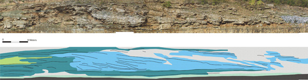
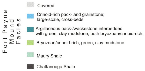
Figure 2. Photograph and interpretation of the eastern margin of a Fort Payne mound.
The basal contact with the Maury Shale is well exposed.
The large-scale,
cross-bedded grainstone unit defines the actual eastern margin,
the origin of which probably involved a major slump.
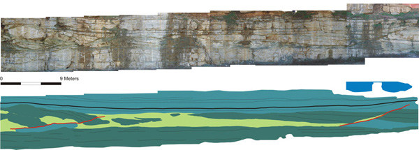
Figure 3. Photograph and interpretation of mound margin beds located on
south side of TN 52 between panoramas 1 and 3, both of which are on the north side of the highway.
Despite the close proximity these beds cannot be easily correlated with those on the north side,
which may indicate differences in original depositional relationships to the buildup
as well as syndepositional deformation of the mound margins.
Celina West, Panorama 3
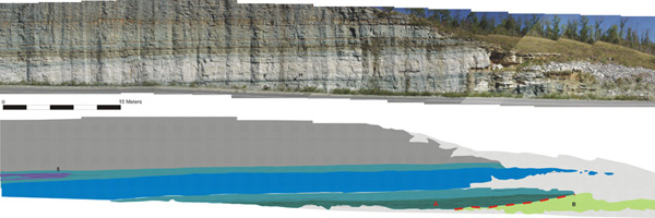
Figure 4. Photograph and interpretation of western margin of this Fort Payne mound.
The green, fossiliferous mudstone "core" is present in the lower right corner;
the succeeding mound facies onlap and blanket this unit.
The basal crinoid-rich grainstones of the heterolithic unit
(A) dramatically thin away from the green mudstone core
(B),
and contain channel-fill, bedding geometries. Locality 5 is explained on Panorama 4.
The contact with the overlying green/gray, siliceous mudstone is sharp and
in places truncates underlying units, see Panorama 4.
Celina West, Panorama 4
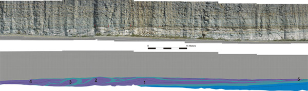
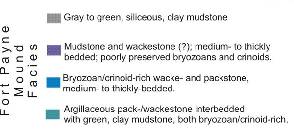
Figure 5. Photograph and interpretation of westernmost portion of the western margin of this Fort Payne mound.
The mud- and wackestone facies (purple) clearly has the geometry of a topographic buildup at locality 1.
This same buildup geometry exits at locality 2, but has been complicated here by penecontemporaneous slumping.
Slumping at localities 3 and 4 has been so pervasive that the original depositional geometry is virtually impossible to interpret.
The geometry present at locality 5 suggests that a buildup sunk down into the underlying heterolithic facies
resulting in both down-bending and lateral movement, largely into the plane of the section,
of this underlying facies.
The contact with the overlying green/gray,
siliceous mudstone is a disconformity based on the obvious truncation (red arrows) of underlying units.
Back to Field trip in the Dale Hollow region
Back to top of Geology of the Fort Payne Formation