
The Kentucky Geological Survey has archived this material, meaning (1) it is for reference, research, or recordkeeping; (2) it was created before April 24, 2026; (3) and the material has not been changed or altered since being archived. Please refer to our KGS Accessibility page for more information.
KGS Home > Geology of Kentucky
Fort Payne Formation Field Trip in the Dale Hollow Lake Region
The following descriptions and images are provided by Larry Knox and Frank Stupor Jr., at the Department of Earth Sciences, Tennessee Technological University, Cookeville, TN. Some exposures are along roads while others are only accessible by boat on the lake.
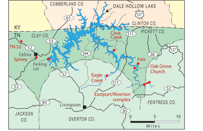
Regional map of known Fort Payne mounds in Tennessee
General Lake Information (links to park maps, boat docks, lake levels, etc.)
Back to top of Geology of the Fort Payne Formation