
The Kentucky Geological Survey has archived this material, meaning (1) it is for reference, research, or recordkeeping; (2) it was created before April 24, 2026; (3) and the material has not been changed or altered since being archived. Please refer to our KGS Accessibility page for more information.
KGS Home > Geology of Kentucky
Spivey mound, TN
Location:
From the junction of TN routes 52 and 53 (about 1 mile south of Celina, TN) go north 0.27 miles and turn right on Spivey driveway. Mound located north of Spivey house.
Latitude/longitude:
36.535360 N, 85.505980 W Celina Geologic Quadrangle map. Order from Tennessee Division of Geology at: www.state.tn.us/environment/tdg/
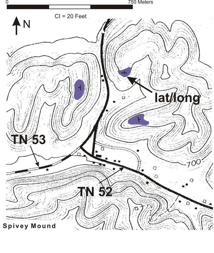
Figure 1. Map of the Spivey mound exposures. Strikes and dips (shown in the purple polygons)
were taken on base of massive capping/flanking beds.
Three Fort Payne mound facies and the underlying Chattanooga Shale are exposed in a man-made cut at this location.
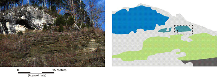
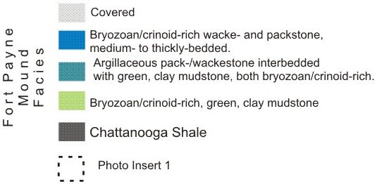
Figure 2. Image and interpretation of one of the exposures of the Fort Payne Formation at Spivey, TN.
Photo insert 1 is shown in Figure 3.
The essentially non-fossiliferous, green, clay mudstone of the Maury Formation, approximately 65 cm-thick (not shown), directly overlies the Chattanooga Shale (shaded dark gray). The basal bryzoan- and crinoid-rich, green, clay mudstone facies of the Fort Payne Formation (shaded light green) has a possible gradational contact, over some 5-10 cm, with the underlying Maury. Localized deposition of this facies produced the topographic relief above the Maury (?) seafloor that resulted in the mound. The heterolithic facies of green, clay mudstone interbedded with argillaceous, wacke/packstone (shaded blue-green), both bryzoan- and crinoid-rich, has a gradational contact, over 0.5 to 1 meter, with the underlying fossiliferous, green, clay mudstone. A thickly-bedded to "massive", bryozoan and crinoid-rich, wacke/packstone (shaded blue) forms the capping and/or flanking unit of this particular mound.
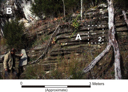
Figure 3. Image of green mudstone and argillaceous carbonates (A) beneath "massive" carbonates
(B). Insert 2 is shown in Figure 4.
At Spivey, fossiliferous, green, clay mudstone interbedded with fossiliferous, argillaceous, wacke/packstones (white A)
is overlain by thickly-bedded to "massive", bryozoan/crinoid-rich, wacke/packstone facies (B) of
the capping and/or flanking unit present at this mound. Both lithologies are bryozoan- and crinoid-rich.
A closeup view of the heterolithic facies is shown below (Figure 4).
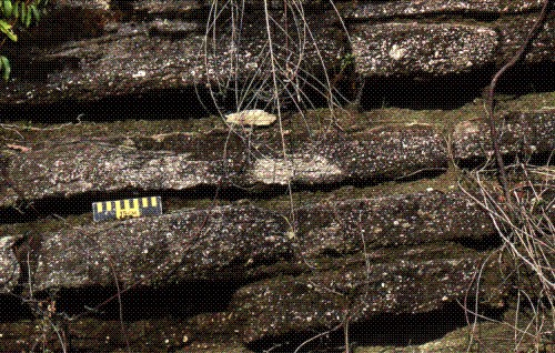
Figure 4. Detailed view of the heterolithic facies: fossiliferous, green, clay mudstone interbedded with fossiliferous,
argillaceous, wacke/packstones, both lithologies are bryozoan- and crinoid-rich. Scale is 15 cm long.
Back to Field trip in the Dale Hollow region
Back to top of Geology of the Fort Payne Formation