
The Kentucky Geological Survey has archived this material, meaning (1) it is for reference, research, or recordkeeping; (2) it was created before April 24, 2026; (3) and the material has not been changed or altered since being archived. Please refer to our KGS Accessibility page for more information.
KGS Home > Geology of Kentucky
Geology of the Fort Payne Formation in south-central Kentucky and Tennessee
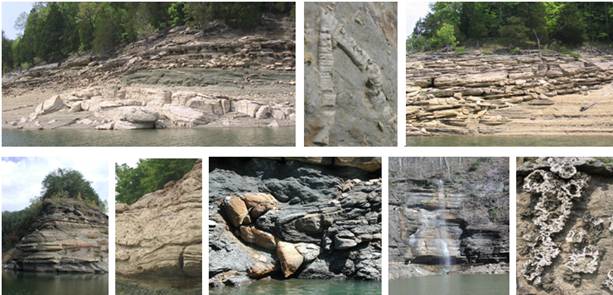
This Web site is designed as a virtual field trip to the Fort Payne Formation, with its famous mud mounds. You can access the information through online maps and stop descriptions, or through linked PDF's of existing field guides. Many of the stops are only accessible by boat on Lake Cumberland and Dale Hollow Lake, but other stops are also described from surface exposures along roads and trails. It is hoped that this collection of material will facilitate research into and field trips of the Fort Payne Formation in the region. Construction on Wolf Creek Dam at Lake Cumberland from 2006 to 2011 led to exceptionally low water levels that have exposed features in the Fort Payne Formation that have not been visible for many years since the river was impounded. Hence, the images and descriptions along the lake, which correspond to low water levels, will also act as an archive of the observed geology when the construction is completed and water levels return to their preconstruction levels.
To cite information on this Web site, please credit Greb, S.F., Potter, P.E., Knox, L.W., Stapor, F.W., Jr., Meyer, D.L., and Ausich, W.I., 2011, Geology of the Fort Payne Formation in south-central Kentucky and Tennessee: Kentucky Geological Survey, and this URL.