
KGS Home > Geology of Kentucky
Faix mound, Dale Hollow Lake, TN
Location:
This mound is best reached by boat from the Sunset boat dock, located where TN 52 crosses Dale Hollow Lake. Travel southeast from the boat dock along the lake for about 4.7 miles to the very southwest corner of the Moodyville 7.5-minute quadrangle.
Latitude/longitude:
36.510240 N, 85.122140 W, on the Moodyville 7.5-minute geologic quadrangle map. The map can be ordered from Tennessee Division of Geology at www.state.tn.us/environment/tdg/
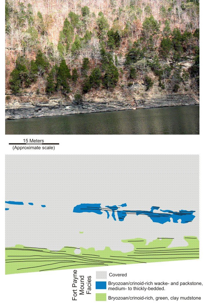
Description. This outcrop well illustrates the complex stratal geometry present in the bryozoan/crinoid-rich, green, clay mudstone facies (shaded light green). The most significant geometry is the obvious, convex-upward bedding that indicates vertical accretion or upbuilding; deposition of this fossiliferous clay mudstone produced the topographic relief of these mounds. The bryozoan/crinoid-rich, wacke- and packstones (shaded blue-green) are a late-stage capping/flanking unit located on the top and flanks of the siliciclastic buildup.
Back to Field trip in the Dale Hollow region
Back to top of Geology of the Fort Payne Formation