
The Kentucky Geological Survey has archived this material, meaning (1) it is for reference, research, or recordkeeping; (2) it was created before April 24, 2026; (3) and the material has not been changed or altered since being archived. Please refer to our KGS Accessibility page for more information.
KGS Home > Geology of Kentucky
Wolf Creek Paleochannel
Location: On Lake Cumberland, along the south shore of Wolf Creek, south (and across the lake) of the Pleasant Hill boat ramp and the intersection of Wolf and Caney Creeks.
Nad-83 Decimal Degree (lat, long): 36.948521, -85.003054
7.5-minute Quadrangle: Jamestown (Thaden and Lewis, 1962)
County, State: Russell, Kentucky
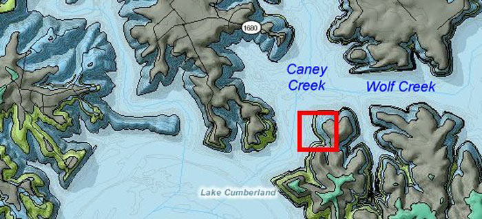
Figure 1. Location of the Caney Creek paleochannel and geology of the area.
From the Kentucky Geological Survey's geologic map information service, based on Thaden and Lewis (1962).
Overview: A large paleochannel in the Fort Payne Formation is exposed along the lake and is only accessible by boat. This paleochannel is described as stop 2 in Lewis and Potter (1978, Fig. 21) and was also discussed in Ausich and Meyer (1990) and Meyer and Ausich, 1992. It is a great example of a paleochannel and is the largest scour or channel on the lake.
Photographs were taken on May 11, 2008, when water level was at 680.08 ft, and on March 15, 2008, when water level was higher at 695 ft. The top of the paleochannel is approximately 725 ft.
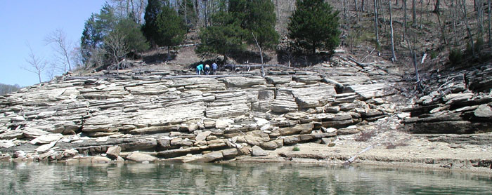
Figure 2. Image of the Caney Creek paleochannel, Fort Payne Formation, from Lake Cumberland. Water level at 695 ft.
Description: This paleochannel truncates more than 50 ft of lateral siltstone and is at least 850 ft wide (Figs. 2-3). Even at higher water levels, the upper part of the channel fill and scour contact is exposed. Ausich and Meyer (1990) described the fill as beds of crinoidal packstone and wackestone. Coarser lithologies are poorly sorted and may contain siltstone clasts as much as 2 in. in diameter. Bedding is thick to very thick (Fig. 3). Graded beds are common. Some beds are crossbedded, with crossbeds oriented N64E° and 10N°, similar to larger-scale accretion dip in the fill. Crinoidal debris and geodes are abundant.
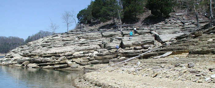
Figure 3. Oblique view of the paleochannel from the shore. Water level is 695 ft.
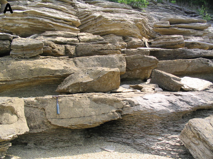
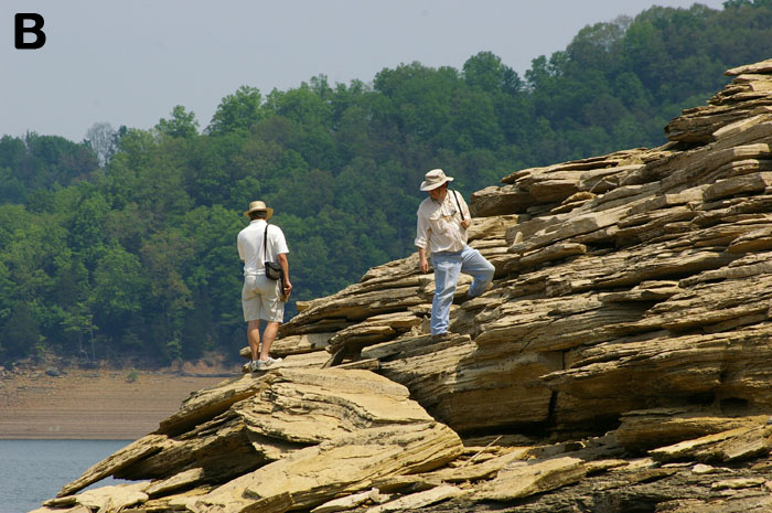
Figure 4. Bedding in the Caney Creek channel fill.
(A) Sharp contact of the paleochannel with lateral siltstones of the Fort Payne Formation.
The change in bed dip above the scour contact is obvious. Hammer for scale.
(B) View of bedding within the fill. Water level is 695 ft.
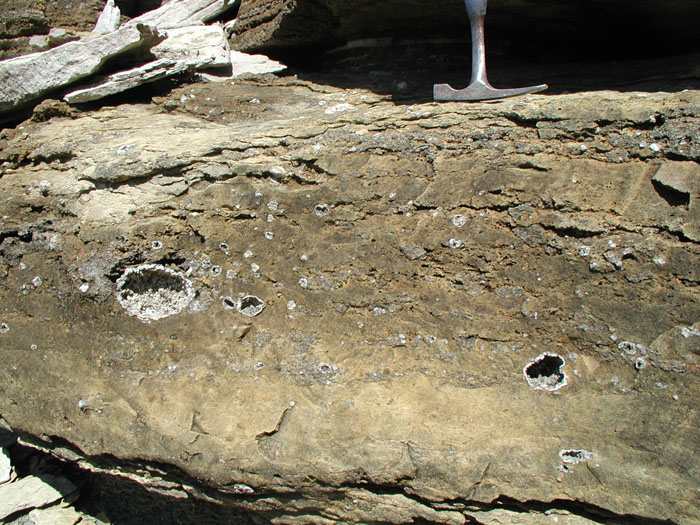
Figure 5. Graded turbidite bed with scour base, overlain by massive to horizontal laminations to climbing ripples.
Geodes are common in the fill. Hammer for scale. Water level is 695 ft.
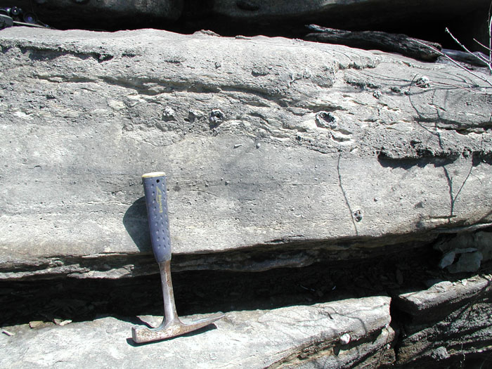
Figure 6. Turbidite bed in the channel fill. Note crinoidal debris. Hammer for scale. Water level is 695 ft.
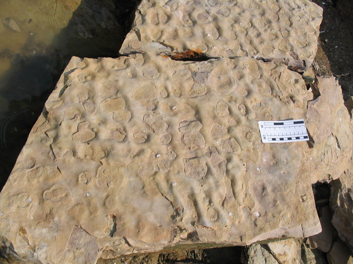
Figure 7. Interference-oscillation ripples on top of a bedding surface. Water level is 680 ft.
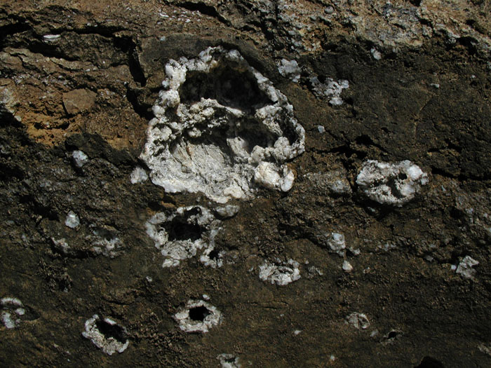
Figure 8. Geodes are common in the channel fill.
The Caney Creek paleochannel is located between the Cave Springs mound (Ausich and Meyer, 1990; Meyer and Ausich, 1992; Meyer and others, 1995), exposed on the main lake at the intersection of Caney and Wolf Creeks, and the Pleasant Hill mound to the north (Fig. 8). Part of the Cave Springs mound can be seen along the shoreline south of the paleochannel (Fig. 9).
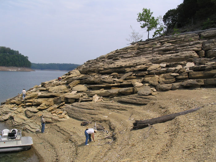
Figure 9. Channel fill along Caney Creek. The Pleasant Hill mound is north of the paleochannel. Lake level is 680 ft.
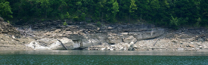
Figure 10. Northwest flank of a mound, viewed from the Caney Creek paleochannel.
The mound may be the back side of the Caney Creek mound,
which is exposed on the main lake on the other side of the ridge. Lake level is 680 ft.
Meyer and Ausich (1992) listed the fossils from the paleochannel. Crinoids dominate the transported fauna in the fill. Seventeen different genera have been documented, although Platycrinites dominate. Other faunal elements include blastoids, sponges, corals, bryozoan, brachiopods, gastropods, bivalves, and a vertebrate (fish?) fragment. Fauna are interpreted to have been transported from upslope.
When looking at the Caney Creek paleochannel, examine the relationship of the channel to lateral bedding. Where is the incision cutting down from? How does this relate to the level of the Pleasant Hill and Cave Springs mounds? How would a large, deep channel like this form in a relatively deep-water environment? Understanding this relationship is important to understanding the depositional sequences in this interval.
References
Continue to Wolf Creek paleoslump
Back to Fort Payne Formation Field Trip in the Lake Cumberland Region
Back to top of Geology of the Fort Payne Formation