
The Kentucky Geological Survey has archived this material, meaning (1) it is for reference, research, or recordkeeping; (2) it was created before April 24, 2026; (3) and the material has not been changed or altered since being archived. Please refer to our KGS Accessibility page for more information.
KGS Home > Geology of Kentucky
Fort Payne Formation -
Lower Contact and Maury Shale
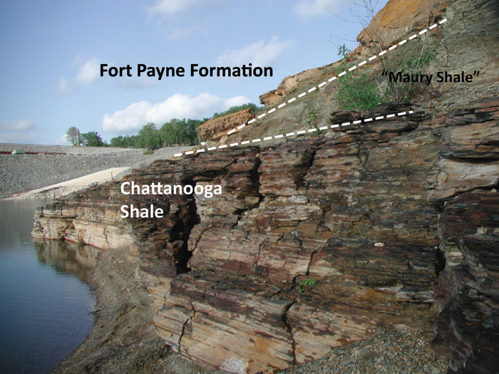
The contact of the Fort Payne and underlying Chattanooga Shale in the Lake Cumberland and Dale Hollow Lake area is sharp, but conformable. A thin green shale equivalent to the Maury Shale of Tennessee overlies the contact. The contact can be seen near Wolf Creek Dam (at low water level on the lake side, and at high water level on the downstream side of the dam) (Lewis and Potter, 1978, stop 4), and along Ky. 61 (Meyer and others, 1997; Krause and Meyer, 2004). The Maury is a green glauconitic shale with phosphate nodules. Although generally less than 3 ft thick, this green shale records slow, relatively continuous pelagic deposition through the Early and Middle Mississippian (Sable and Dever, 1990). It accumulated in a sediment-starved basin west of the Borden delta. The base of the green shale (above the contact with the underlying Chattanooga Shale) is no older than the Siphonodella duplicata zone, and the top of the shale is no older than the mid Scoliognathus anchoralis-Doliognathus latus zone based on conodonts (Leslie and others, 1996). In contrast, the remaining 200 to 300 ft of the Fort Payne Formation was deposited entirely in the Middle Mississippian (late Osagean) Gnathodus texanus zone.
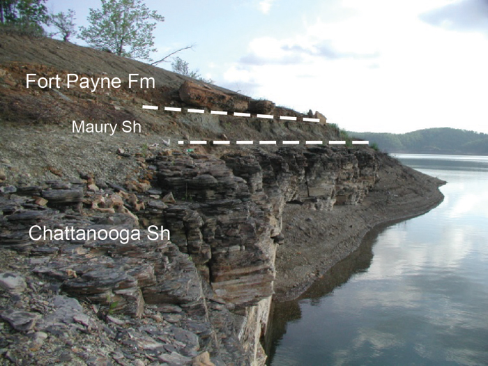
Photographs shown here were taken at water levels of approximately 680 ft. The basal contact of the shale is between 700 and 710 ft.
Continue to Mud mounds of the Fort Payne Formation
Back to Stratigraphy of the Fort Payne Formation
Back to top of Geology of the Fort Payne Formation