
Current Projects
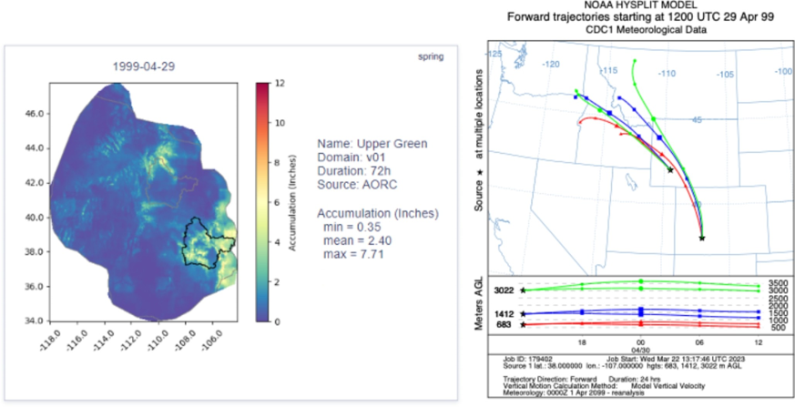
Flood Modeling
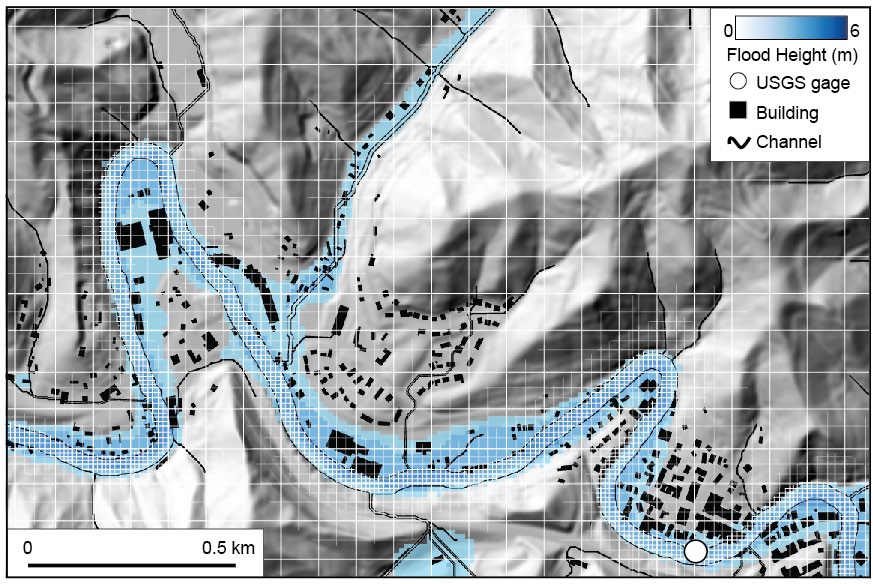
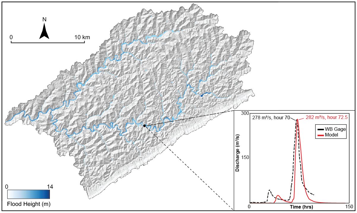
Key Features:
- Models can be calibrated to specific storms (Eastern Kentucky, North Carolina)
- Mitigation implications and climate scenario testing capabilities
- High-resolution channel preservation with efficient computation
- GPU-accelerated processing for rapid results
- Luciano Cardone (Ph.D. student) is working on reconstructing paleo-storms from flood sediments in the Kentucky River Catchment.
- Mackenzie Choffel (M.S. student) is working on developing stochastic storms, including the predicted effects of climatic change, to assess their effects on flooding along the Swannanoa River, North Carolina.
- Kennedy Ochieng (Ph.D. student) will develop models for the Coal River catchment which had record flooding in 2021 and recent flooding in February 2025
Products to Date:
- 1st SP&M-enabled publication on Flooding is out (Swallom et al., 2025)
- 2 training workshops scheduled
- Amy Collick at Morehead State University collaboration
- Aaron Maxwell at West Virgina University
Monte Carlo Analysis
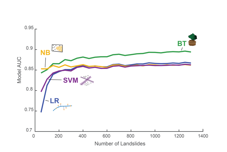
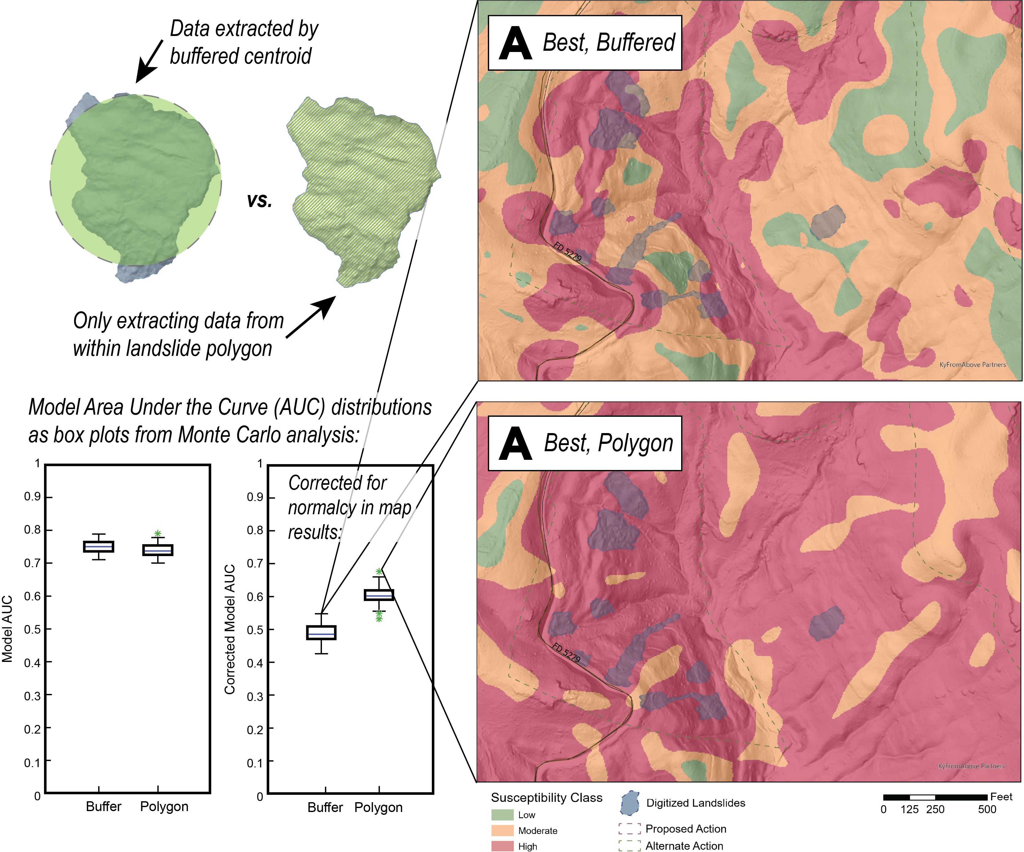
Comprehensive assessment of machine learning approaches for landslide susceptibility modeling in Kentucky's diverse geological settings.
Research Focus:
- Detailed analysis of relationship between inventory and susceptibility results
- Thousands of models generated within sensitivity assessment framework
- Comprehensive evaluation of different machine learning algorithms (SVM, LR, NB, BT)
- Statistical validation using AUC and model performance metrics
- Regional adaptation for Appalachian terrain characteristics
Ongoing Activities:
- 1st SP&M-enabled publication on landslide hazard in eastern Kentucky (Swallom et al., 2025)
- Statewide landslide inventory compilation and validation
- Multi-algorithm performance comparison study
- Climate-informed susceptibility modeling development
Future Directions
Stochastic Storm Analysis
Research Goal: Develop probabilistic frameworks for extreme weather event analysis to improve flood and landslide hazard prediction.
Approach:
- Aggregating precipitation from historical storms (tropical cyclones, stalled fronts)
- Stochastic transposition of storm patterns across different regions
- Probabilistic basis for iterating flood and landslide models
- Integration with climate change scenarios
Foundation Research: Lawler, S., Deshotel, M., Dietrich, A.H. et al. Application of stochastic storm transposition for hydrologic modeling in the mountainous western US. Stoch Environ Res Risk Assess (2024).
Debris Flow Modelling
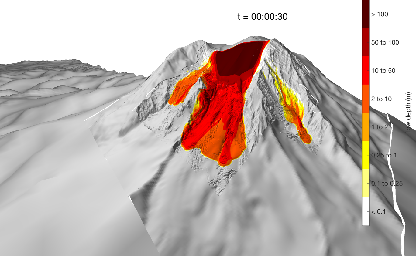
Research Vision: Bridge the gap between landslide and flood hazard modeling through integrated debris flow simulation capabilities.
Planned Development:
- Implementation of D-Claw for debris flow simulation
- Integration with existing landslide susceptibility models
- Coupling with hydrological modeling workflows
- Multi-hazard risk assessment frameworks
- Community impact and evacuation planning tools
Strategic Impact: This capability represents the next logical step to grow the SP&M lab community and establish Kentucky as a leader in integrated surface process hazard modeling.