
Algorithm Development & GUI Tools
Converting MATLAB scripts into standalone GUI programs for broader accessibility and usability.
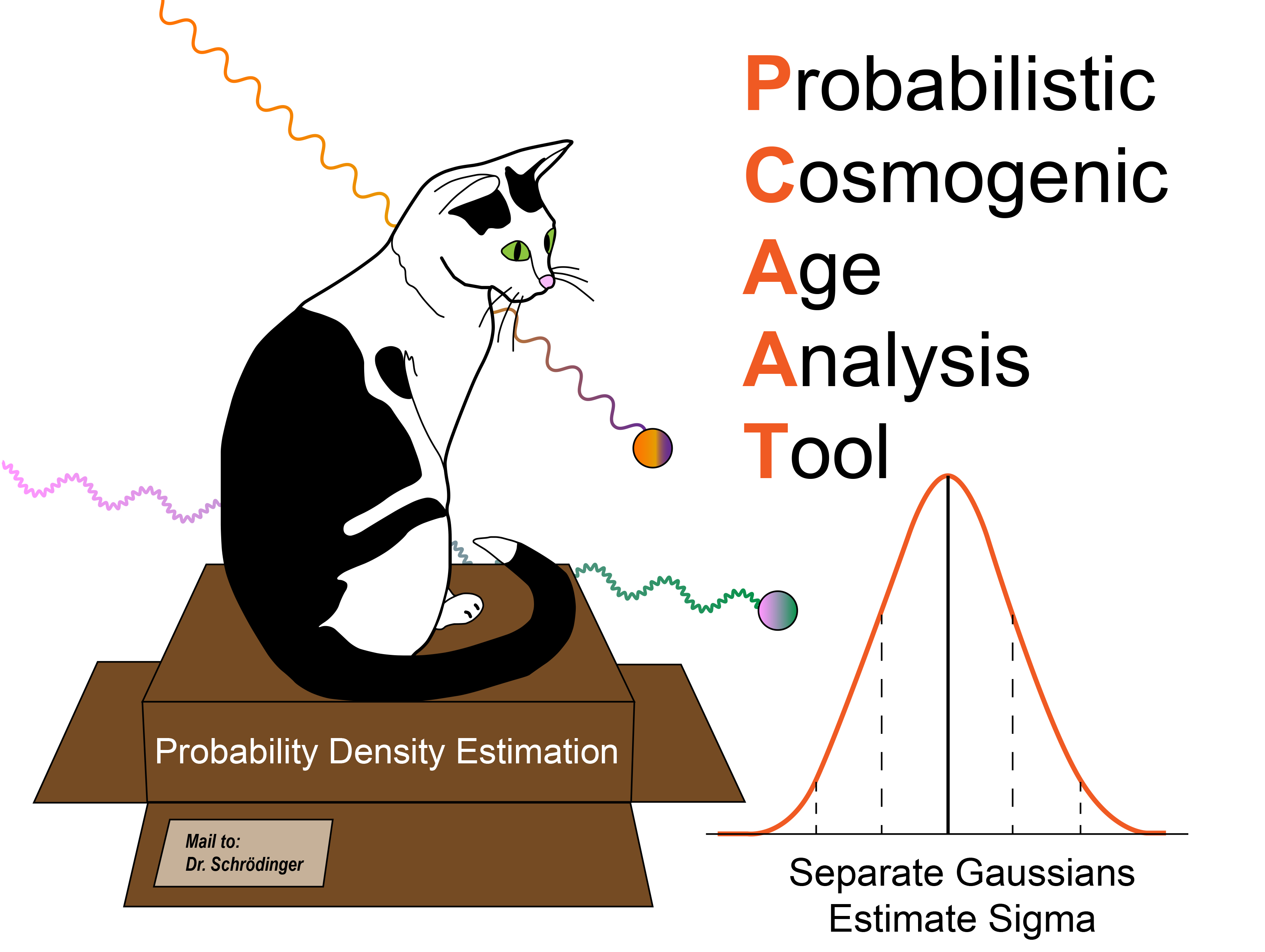
P-CAAT (Probabilistic Cosmogenic Age Analysis Tool)
- Takes multimodal probabilistic age data and deconvolves them into normal distributions (Gaussians)
- Statistical analysis of degraded vs. inherited age populations
- Comprehensive uncertainty quantification
- Handles complex age distributions with statistical rigor
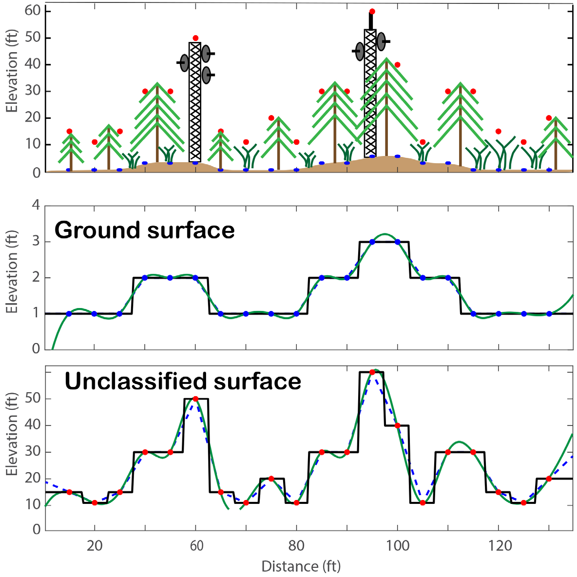
LASTiff (LAS to GeoTIFF Converter)
- Converts LAS files to GeoTiffs
- Interpolates raw point cloud data to regularly spaced gridded surfaces
- Eliminates mismatch between ground and vegetation layers
- Generates multiple surface products: DSM, DTM, DCM
- Streamlines LiDAR data processing workflows
Remote Sensing & Field Methods
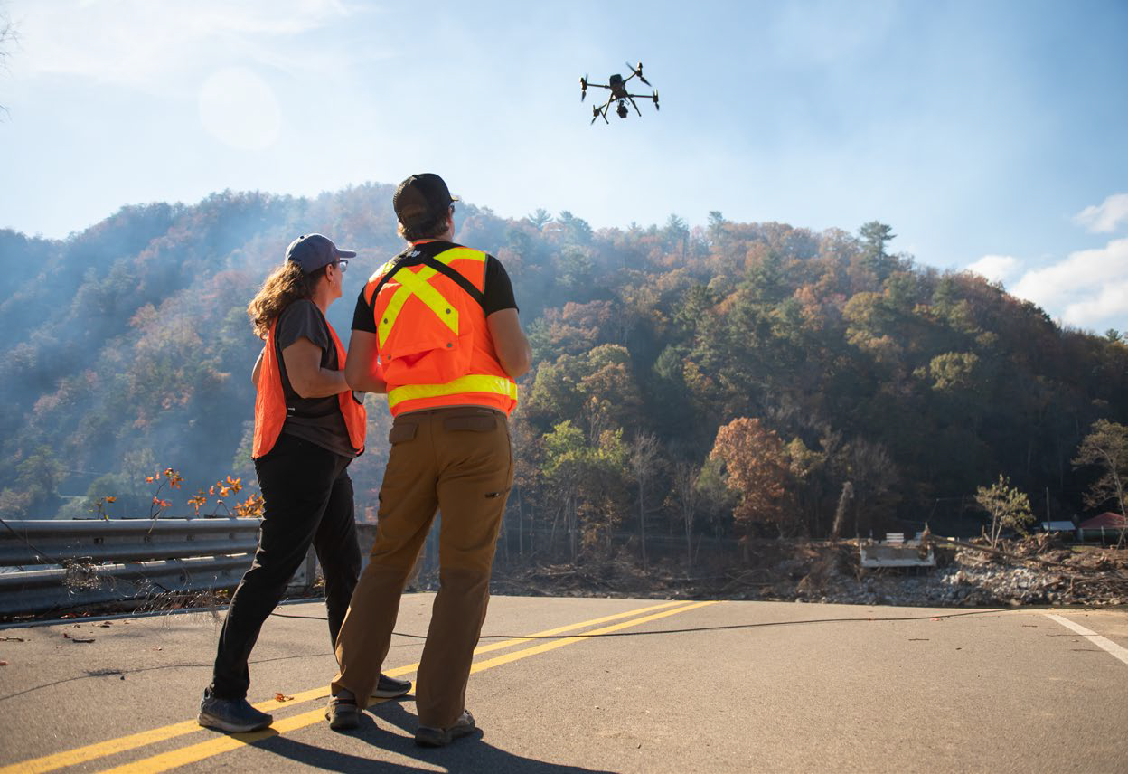
Drone LiDAR Applications
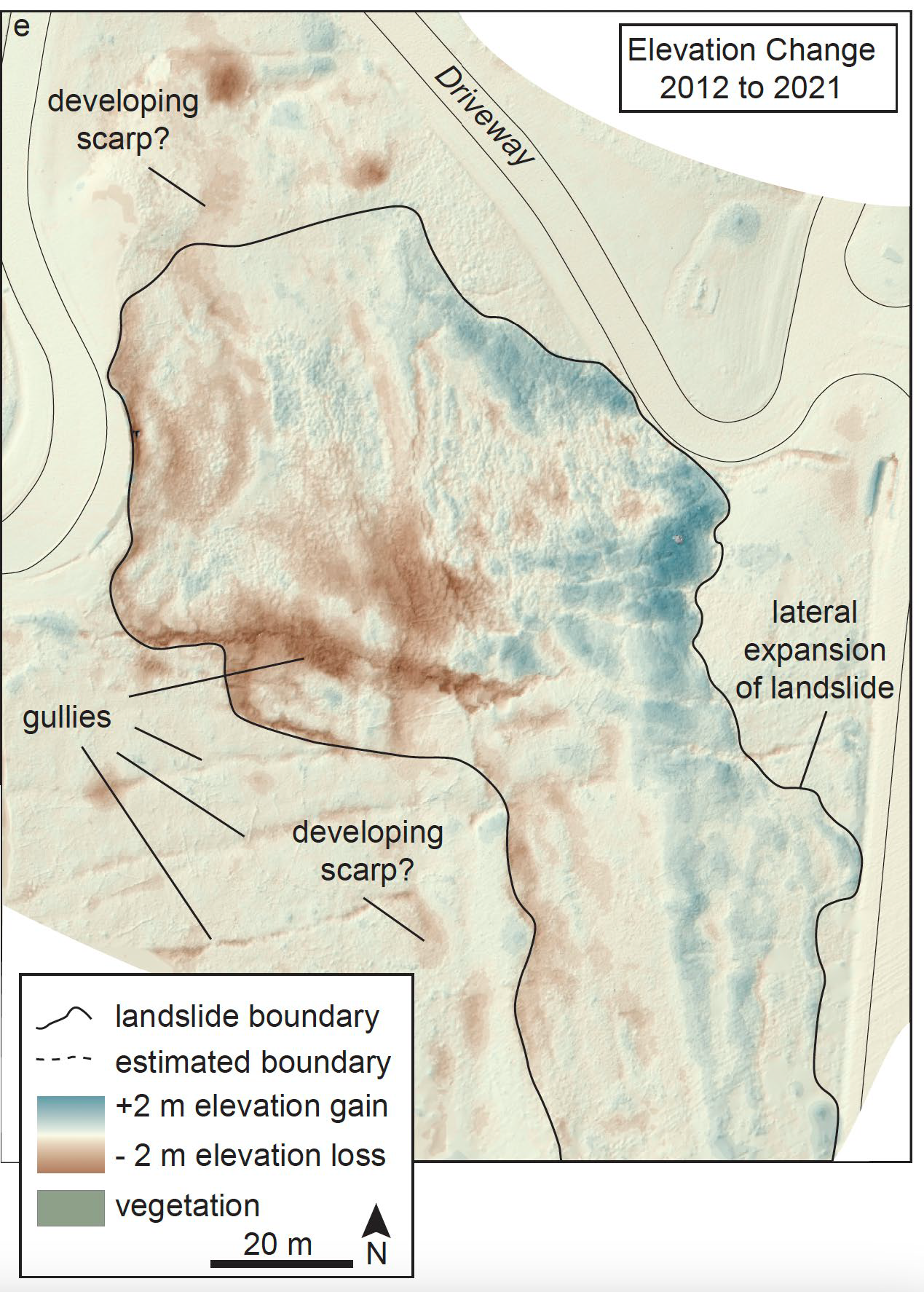
Using DJI Terra and drone-based LiDAR for high-resolution monitoring of surface processes:
- High-resolution topographic mapping
- Change detection analysis (elevation change mapping)
- Landslide boundary delineation and monitoring
- Stream channel morphology assessment
- Pre- and post-event comparative analysis
- Mass movement and fluvial erosion surveys
Computational Methods
Core Philosophy: Combine and streamline complex workflows to develop integrated surface process models that elucidate landscape evolution, hazard prediction & response under changing climate regimes.
Machine Learning Algorithms
- Brute force implementation of ML models
- Monte Carlo simulations for uncertainty quantification
- Stochastic modeling approaches
- Support Vector Machines (SVM)
- Logistic Regression (LR)
- Naive Bayes (NB)
- Boosted Trees (BT)
High-Performance Computing
- GPU-accelerated processing workflows
- Parallel computing for large datasets
- Memory-optimized algorithms for big data (192 GB RAM)
- Real-time processing capabilities
- Multi-GPU distributed computing
Statistical Analysis
- Probabilistic modeling and uncertainty analysis
- Time series analysis and forecasting
- Multivariate statistical methods
- Model validation and performance assessment
- Cross-validation and sensitivity analysis
Geospatial Analysis
- Digital elevation model (DEM) processing
- Watershed delineation and analysis
- Slope stability assessment
- Flow accumulation and routing
- Spatial interpolation techniques
Modeling & Simulation Capabilities
Hydrological Modeling
- Flood inundation modeling with TUFLOW
- Sub-grid sampling for computational efficiency
- Storm-specific calibration capabilities
- Climate scenario testing
- GPU-accelerated simulation (12 min per county)
Landslide Susceptibility
- Data-driven statistical modeling
- Machine learning-based susceptibility mapping
- Inventory-based model validation
- Multi-algorithm comparison frameworks
- Regional-scale hazard assessment
Surface Process Integration
- Multi-hazard modeling approaches
- Cross-scale process integration
- Landscape evolution modeling
- Climate-hazard coupling
- Risk assessment for rural communities
Workflow Automation
- Custom script development
- GUI creation for accessibility
- Batch processing capabilities
- Reproducible research workflows
- Integration with existing software packages