| Topography | ||
|
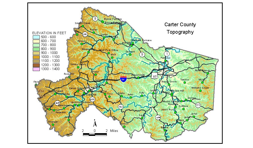
Discussion from McGrain and Currens (1978) Carter
County is located on the edge of the Eastern Kentucky Coal Field
in northeastern Kentucky. The area is well dissected, and flat areas
are not common except along the valleys of Little Sandy River, Little
Fork of Little Sandy River, and parts of Tygarts Creek. A few upland
flat areas are found in the vicinity of Olive Hill where resistant sandstones
are present. Steep slopes are common in most parts of the county, and
vertical sandstone bluffs are found along and near Tygarts Creek in
the vicinity of Carter Caves State Park and along Big and Little Sinking
Creeks in the Grahn area. The lowest elevation is approximately 542 feet, where the Little Sandy
River leaves the county. Oxbow lakes and abandoned meanders are present
in the valley north of Grayson. The normal pool level of Grayson Lake
on Little Sandy River south of Grayson is 645 feet. The elevation of
Tygarts Creek where it leaves the county is approximately 600 feet. Carter Caves State Park occupies a scenic area adjacent to the entrenched meandering valley of Tygarts Creek. The elevation of Ky. 182 at the entrance to the park is approximately 700 feet. Highest points in the park exceed 1,000 feet. The elevation of Smoky Valley Lake is 715 feet, and the park lodge is about 930 feet. Other elevations in the county include Carter at 674 feet; Globe, 821 feet; Grahn, 700 feet; Grayson, the county seat, 608 feet; Lawton, 790 feet; Olive Hill, 760 feet; Soldier, 985 feet; and Willard, 630 feet. The 7.5-minute topographic quadrangle maps that cover Carter County
are shown by name and index code (Kentucky Natural Resources and Environmental
Protection Cabinet) on the index
map. Previous--Next--Back to "Groundwater Resources in Kentucky"
|
||