| Topography | ||
|
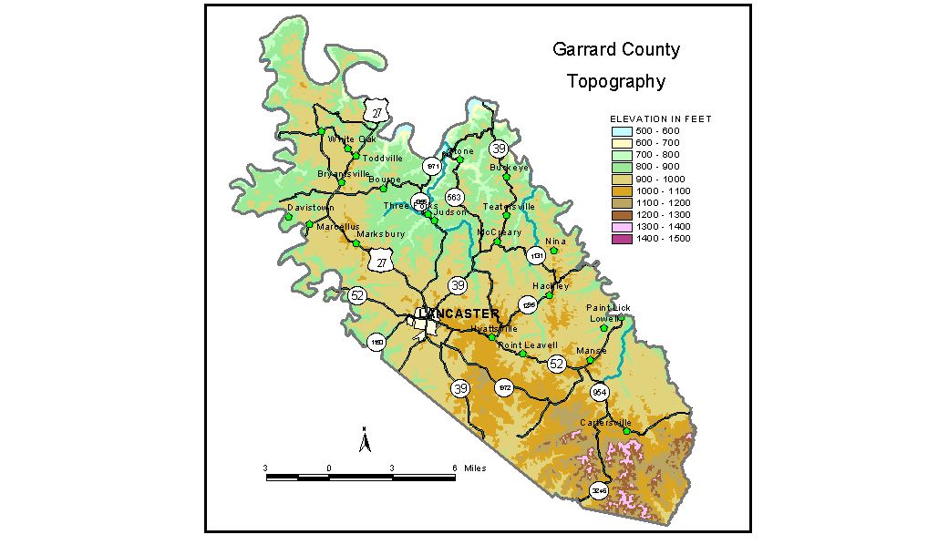
Discussion from McGrain and Currens (1978) Garrard
County, situated in central Kentucky, includes parts of the Inner
Bluegrass, Outer Bluegrass, and Knobs (Highland Rim) physiographic regions.
The county is a dissected upland with a gently rolling to hilly topography.
The topography becomes more rugged near the deep valleys of the Kentucky
River, which marks the northern boundary, and the Dix River, which forms
the northwestern boundary. A nearly flat, slightly karstic, upland plain,
at 900 to 1,000 feet, occupies part of northwestern Garrard County between
U.S. 27 and Harrington Lake (Dix River). Elsewhere, except locally in
the vicinity of Lancaster, flat areas are rare. Local reliefs along
the Kentucky River exceed 300 feet. Local reliefs along Harrington Lake
are generally between 150 and 200 feet. The lowest elevation is 514 feet, the normal pool level of the Kentucky
River where it leaves the county. The spillway elevation of Dix Dam
at Harrington Lake is 750 feet. The elevation of Lancaster, at the courthouse, is 1,032 feet. Other elevations include Bryantsville, 953 feet; Burdette Knob, a prominent landmark 2 miles south of Bryantsville, 1,100 feet; and Paint Lick, 810 feet. The 7.5-minute topographic quadrangle maps that cover Garrard County
are shown, by name and by index code (Kentucky Natural Resources and
Environmental Protection Cabinet) on the index
map. Previous--Next--Back to "Groundwater Resources in Kentucky"
|
||