| Topography | ||
|
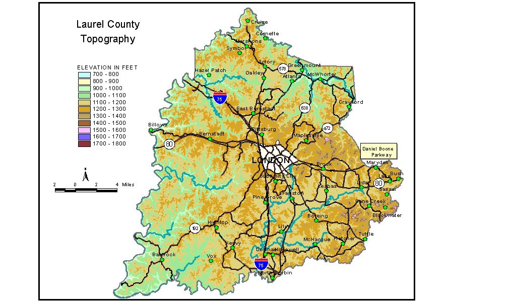
Discussion from McGrain and Currens (1978) Laurel
County is located in the coal field area of southeastern Kentucky.
The terrain in this part of the Eastern Kentucky coal field looks more
like a dissected plateau than a mountain range. Ridgetop elevations
of 1,200 feet are common in the western and central parts of the county
and range up to 1,700 feet in the east. Resistant sandstones have caused
a number of ridges to be flat topped and also have been the base upon
which expanses of nearly flat land have developed in the London and
Lily areas. The highest elevations in the county are in the southeast. The Laurel-Knox
County line approximates Elevations of general interest include Bernstadt at 1,260 feet; East Bernstadt, 1,182 feet; Levi Jackson State Park, approximately 1,200 feet; Lily, 1131 feet; London, the county seat, 1,255 feet; London-Corbin Airport, 1,180 feet; North Corbin, 1,127 feet; Pittsburg, 1,153 feet; and normal pool level of Wood Creek Lake, 1020 feet. Laurel River Lake impounds waters of Laurel River 2.3 miles above its confluence with Cumberland River. The conservation pool has an elevation of 982 feet, and the elevation of the power pool is 1,018.5 feet. The 7.5-minute topographic quadrangle maps that cover the county are
shown, by name and by index code (Kentucky Natural Resources and Environmental
Protection Cabinet) on the index
map. Previous--Next--Back to "Groundwater Resources in Kentucky"
|
||