| Topography | ||
|
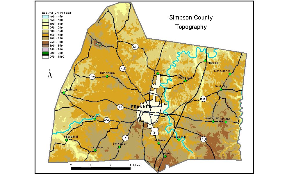
Discussion from McGrain and Currens (1978) Simpson County is in the Mississippian Plateaus area of southern Kentucky. For the most part, it is a gently rolling plain characterized by underground drainage features. Sinkhole topography is found in almost every part of the county, but it is more pronounced in the central and western areas than in the east. Elevations on the sinkhole plain range from almost 800 feet in the southeastern corner of the county to 650 feet in the northern part. The highest elevation in Simpson County, 928 feet, is the top of Pilot Knob, an isolated hill near the northwestern corner of the county. This prominent landmark rises more than 200 feet above the surrounding area. The lowest elevation, 490 feet, is the point where West Fork of Drakes Creek leaves the northern part of the county. The elevation of Franklin, at the courthouse, is 720 feet. Elevations at other communities are Gold City, 722 feet; Hickory Flat, 709 feet; Hillsdale, 666 feet; Prices Mill, 577 feet; Providence, 736 feet; and Salmons, 675 feet. The 7.5-minute topographic quadrangle maps that cover the county are shown, by name and by index code (Kentucky Natural Resources and Environmental Protection Cabinet) on the index map. Previous--Next--Back to "Groundwater Resources in Kentucky"
|
||