| Topography | ||
|
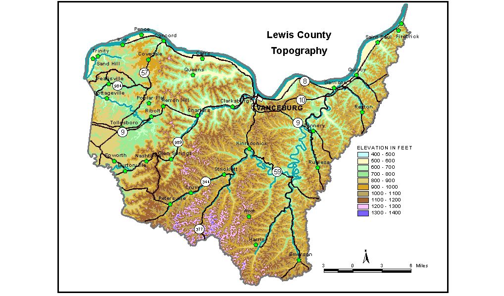
Discussion from McGrain and Currens (1978) Lewis
County is a highly dissected upland area in northeastern Kentucky.
The topography is hilly to mountainous. On the western edge of the county,
the topography is typical of the Outer Blue Grass, but elsewhere it
expresses the characteristics of the Highland Rim. Ridgetop elevations
generally exceed 1000 feet and expanses of flat land are few. An exception
is the Tollesboro area where broad upland flats are developed on resistant
rock formations. Local reliefs of 300 feet or more are common in many parts of the county,
and the slopes are steep. The greatest local relief is 2 miles west
of Garrison, from Round Top (1,220 feet) on the bluff overlooking the
Ohio River down to river level (485 feet), a difference in elevation
of 745 feet. The highest elevation in Lewis County, 1400 feet, is a knob near the
Lewis-Fleming County line about 2 1/2 miles south of Petersville. Elevations
in excess of 1,300 feet are present along the Lewis-Fleming and Lewis-Rowan
County lines where they follow a drainage divide between Kinniconick
Creek and Licking River. Eskalapia Mountain, a prominent high area southeast
of Tollesboro, attains an elevation of 1,200 feet. The elevation of Vanceburg, the county seat, is 525 feet. Other elevations
in the county are Burtonville, The 7.5-minute topographic quadrangle maps that cover the county are
shown, by name and by index code (Kentucky Natural Resources and Environmental
Protection Cabinet) on the index
map. Previous--Next--Back to "Groundwater Resources in Kentucky"
|
||