| Topography | ||
|
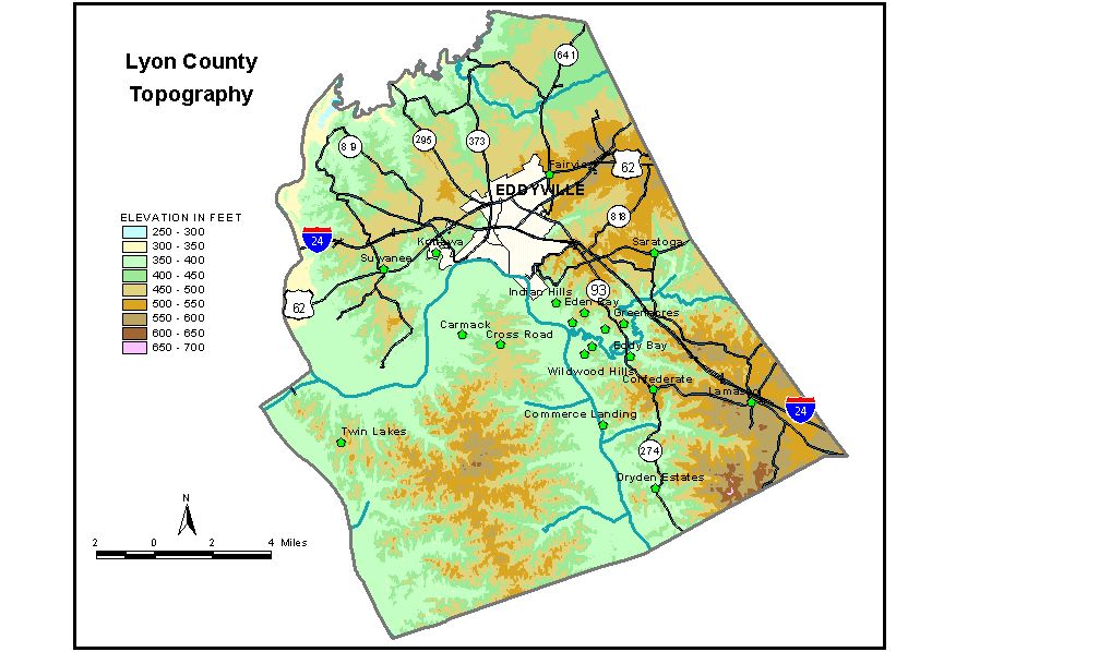
Discussion from McGrain and Currens (1978) Lyon
County is in the Mississippian Plateaus area of western Kentucky.
Kentucky Lake marks the southwestern boundary of the county and the
Cumberland River marks most of the northwestern boundary. Lake Barkley,
a multi-purpose reservoir on the Cumberland River, crosses the center
of the county. The two lakes are connected by Barkley Canal on the western
edge of the county which permits the two impoundments to have a common
normal pool elevation of 359 feet. The lowest elevation in the county,
approximately 305 feet, is on the Cumberland River at the mouth of Livingston
Creek. The highest elevations are in the southeastern part of the county. The highest point, 670 feet, is on a ridge on the Lyon-Trigg County line approximately 2 miles northeast of Lake Barkley. The area known as "The Land Between the Lakes" is a hilly
area with many ridgetop elevations exceeding 500 feet. The highest elevations
in this part of the county are found on the drainage divide between
Kentucky Lake and Lake Barkley. Probably the highest natural point here
is at the base of the lookout tower (Hematite triangulation station)
in the southern part of the county where an elevation of 590 feet is
recorded. Iron Hill, south of Suwanee, is 520 feet. The elevation of Eddyville, the county seat, is 470 feet. Other elevations are Kuttawa (new), 450 feet; Kuttawa (old) 390 feet; and Lamasco, 560 feet. The highest elevation in Vista Ridge Park, located on a conspicuous northeast- trending ridge at old Kuttawa, is 580 feet. The 7.5-minute topographic quadrangle maps that cover the county are
shown, by name and by index code (Kentucky Natural Resources and Environmental
Protection Cabinet) on the index
map. Previous--Next--Back to "Groundwater Resources in Kentucky"
|
||