| Topography | ||
|
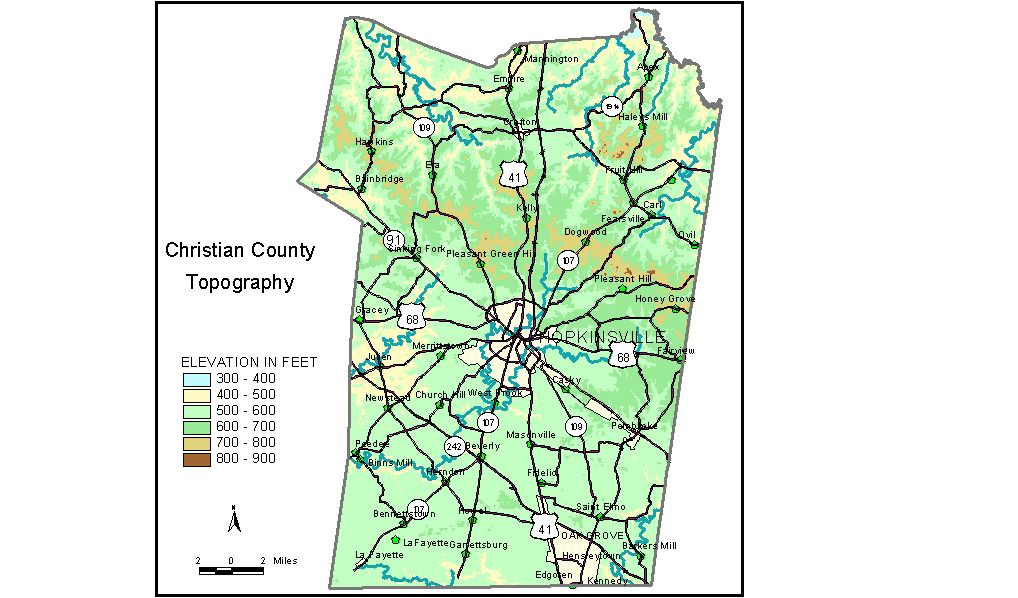
Discussion from McGrain and Currens (1978) Christian
County, located in the Mississippian Plateaus area of southwestern
Kentucky, is bordered on the south by the Kentucky-Tennessee state line. The northern part of the county, generally north of U.S. 68, is a higher
plateau, characterized by sandstone-capped hills and ridges that produce
higher elevations and more rugged terrain. Normal stream drainage patterns
prevail here. The highest elevations are associated with knobs perched
on ridges in the vicinity of a drainage divide that separates north-flowing
tributaries of the Pond and Tradewater Rivers from the south- and west-flowing
tributaries of the Cumberland River. Pilot Rock, on the Christian-Todd
County line, is the highest point at 966 feet. Pine Knob is 863 feet.
Slopes associated with the sandstone-capped hills and ridges are commonly
steep, and may be locally precipitous. Local reliefs may be as great
as 300 to 400 feet, but are generally less. The lowest elevation, 390 feet, is at the northwestern corner of the county where the Tradewater River enters Hopkins County. The elevation of the Pond River, at the northeastern corner of the county, is approximately 395 feet. The valleys of both streams are fairly wide and commonly marshy. There are several small man-made lakes in Christian County. The elevations
of those near Hopkinsville are Lake Baxley, 560 feet; Lake Blythe, 593
feet; Buntin Lake, 636 feet; Lake Morris, 581 feet; and Lake Tandy,
570 feet. Pennyroyal State Park and Pennyroyal State Forest are located principally
in northwestern Christian County. Pennyroyal Lake has an elevation of
458 feet, and Lake Beshear, partly in Christian County, is 410 feet.
Highest ridges in the state forest exceed 750 feet. The 7.5-minute topographic quadrangle maps that cover Christian County
are shown by name and index code (Kentucky Natural Resources and Environmental
Protection Cabinet) on the index
map. Previous--Next--Back to "Groundwater Resources in Kentucky"
|
||