| Topography | ||
|
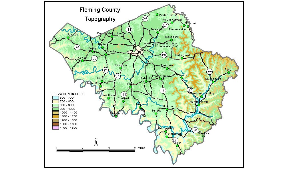
Discussion from McGrain and Currens (1978) Two distinct landscapes are present in Fleming
County. The western part of the county is in the Outer Bluegrass
Region and is characterized by gently rolling hills and mild local relief.
Ridgetops, some of which are nearly flat, have elevations ranging between
900 and 1,000 feet. Valleys of the small streams are commonly less than
100 feet lower. The Licking River marks much of the western boundary of Fleming County.
Its meandering valley is generally entrenched some 200 feet. Locally,
the valley and some of its tributaries are widened at the expense of
softer rock. The lowest elevation in the county is 590 feet, at the
point where the Licking River leaves the county. The elevation of Flemingsburg, the county seat, is 823 feet. Other elevations include Cowan, 912 feet; Elizaville, 909 feet; Ewing, 940 feet; Grange City, 815 feet; Hillsboro, 868 feet; Mount Carmel, 886 feet; Nepton, 846 feet; Plummers Landing, 765 feet; Poplar Plains, 915 feet; Sherburne, 650 feet; and Wallingford, 795 feet. The 7.5-minute topographic quadrangle maps that cover Fleming County
are shown, by name and by index code (Kentucky Natural Resources and
Environmental Protection Cabinet) on the index
map. Previous--Next--Back to "Groundwater Resources in Kentucky"
|
||