| Foreword | ||
|
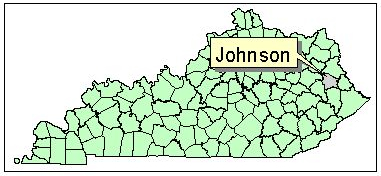
This report on the groundwater resources of Johnson County was prepared for the Water Resource Development Commission by the Kentucky Geological Survey. Reports were prepared for each of Kentucky's 120 counties. These reports complement other county planning reports of the Commission, including Strategic Water Development Plans and Strategic Wastewater Treatment Plans, and the Division of Water's County Water Supply Plans.
Each groundwater resource report is a compilation of information on hydrology, geology, topography, water supply, and water quality taken from maps, reports, and data collected from 1940 to 2000. The primary mode of access to the information is via links from the report to the Internet--for example, by linking to the Water Research Library on the Kentucky Geological Survey's Web site. The digital form of the report, and its ability to link to data anywhere on the Internet, makes it a dynamic tool for gathering information. The current compilation is by no means exhaustive: no doubt valuable data have been overlooked. As new or more-detailed information becomes available, it can be easily linked into this report. Although this report may be of value to planners and geologists for strategic planning and feasibility studies, it cannot replace field investigation for the development or assessment of site-specific groundwater resources. Disclaimer Statement: The Kentucky Geological Survey (KGS) is constantly gathering data from multiple sources, interpreting the data it gathers, and reflecting its interpretations on maps such as those in this report. Reasonable efforts have been made by KGS to verify that these maps and the digital data provided thereon accurately interpret the source data used in its preparation; however, these maps may contain omissions and errors in scale, resolution, rectification, positional accuracy, development methodology, interpretations of source data, and other circumstances. As additional data become available to KGS, and as verification of source data continues, these maps may be reinterpreted or updated by KGS. These maps are designed at a designated scale and should not be enlarged. Furthermore, these maps should not be used for navigation, engineering, legal, or any other site-specific use. Nothing contained herein shall be deemed an expressed or implied waiver of the sovereign immunity of the Commonwealth or its duly authorized reprsentatives, agents, or employees. |
||