| Topography | ||
|
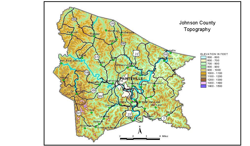
Discussion from McGrain and Currens (1978) Johnson
County is in the Eastern Kentucky coal field. The area is mountainous,
and local reliefs of 400 to 500 feet prevail over most of the county.
The area is well dissected, and the only flat areas are along the valleys
of the major streams. Rugged, rocky cliffs line portions of the valleysof
Paint and Little Paint Creeks. Upland elevations in excess of 1,000
feet are found in all parts of the county, and ridgetop elevations of
1,200 to 1,400 feet are common. Stuffley Knob, about 2 miles south-southeast
of Oil Springs, is the highest point in the county with an elevation
of 1,508 feet. The elevation of Paintsville, the county seat, is about 620 feet. Elevations at other communities are Flat Gap, 815 feet; Offutt, 620 feet; Oil Springs, 843 feet; Redbush, 811 feet; Sitka, 700 feet; Staffordsville, 628 feet; and West Van Lear, 622 feet. The 7.5-minute topographic quadrangle maps that cover the county are shown, by name and by index code (Kentucky Natural Resources and Environmental Protection Cabinet) on the index map. Previous--Next--Back to "Groundwater Resources in Kentucky"
|
||