| Topography | ||
|
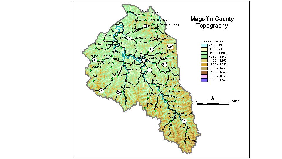
Discussion from McGrain and Currens (1978) Magoffin
County is in the Eastern Kentucky Coal Field. It is a well-dissected
upland typical of the Cumberland Plateau area. The highest elevations are in the southern part of the county along and near the drainage divide between Licking and Big Sandy Rivers. The highest elevation, 1,640 feet, is on the Magoffin-Floyd County line near the southeastern tip of the county. The lowest elevations and the location of the main areas of flat lands
are along the valley of the Licking River, which crosses Magoffin County
from southeast to northwest. The lowest point, approximately 785 feet,
is the elevation of Licking River where it leaves the northwestern boundary
of the county. The communities are located in the valleys. The elevation of Salyersville, the county seat, is 854 feet. Other elevations are Ivyton, 954 feet; Royalton, 890 feet; Seitz, 884 feet; Tiptop, 1,040 feet; Wheelersburg, 856 feet; and Wonnie, 819 feet. The 7.5-minute topographic quadrangle maps that cover Magoffin County
are shown, by name and by index code (Kentucky Natural Resources and
Environmental Protection Cabinet) on the index
map. Previous--Next--Back to "Groundwater Resources in Kentucky"
|
||