
The Kentucky Geological Survey has archived this material, meaning (1) it is for reference, research, or recordkeeping; (2) it was created before April 24, 2026; (3) and the material has not been changed or altered since being archived. Please refer to our KGS Accessibility page for more information.
KGS Home > Geology of Kentucky
Greasy Creek Paleochannel
Location: Along the western shore of Greasy Creek, Lake Cumberland, south of the Lily Creek boat ramp.
Nad-83 Decimal Degree (lat, long): 36.958591, -85.035795
7.5-minute Quadrangle: Jamestown (Thaden and Lewis, 1962)
County, State: Russell, Kentucky
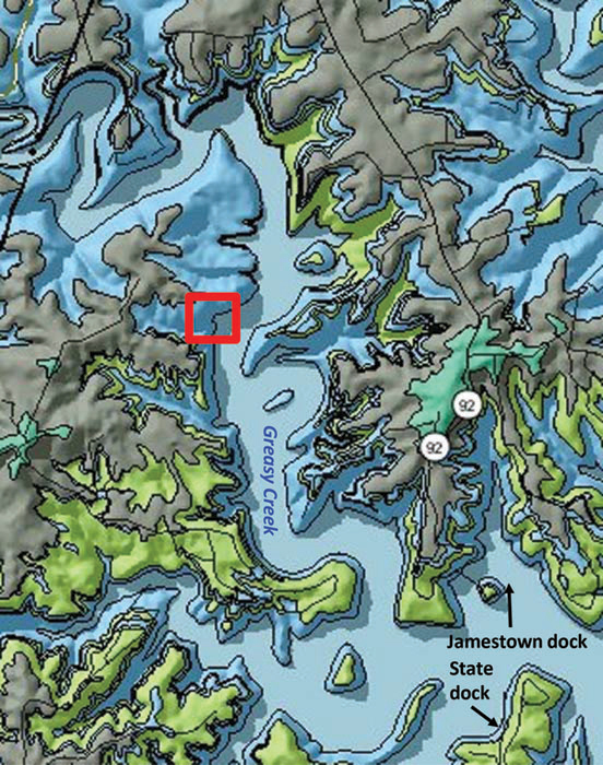
Figure 1. Location of the Greasy Creek paleochannel and geology of the area.
From the Kentucky Geological Survey's geologic map information service, based on Thaden and Lewis (1962).
Overview: This paleochannel is located along Greasy Creek (Fig. 1). It is one of at least two in the Fort Payne Formation preserved along the margin of the lake. The Greasy Creek paleochannel is filled mostly with shale (Fig. 2). A larger paleochannel on Caney Creek is filled with crinoidal packstone and wackestones. A comparison of the two paleochannels provides insight into the depositional facies between the famous mud mounds.
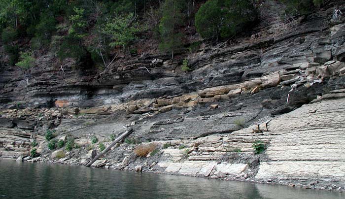
Figure 2. The Greasy Creek paleochannel. Lake level is 678.96 ft.
Description: Most of the Greasy Creek shoreline consists of well-laminated carbonates and siltstones that are flat-lying or arranged in onlapping packages capped by dark gray, bioturbated siltstone. At this stop, the continuous bedding of the lower Fort Payne is interrupted by a series of small scours, slumps, and a larger scour-based, channel-form feature filled with dark siltstone (Figs. 2, 3A-C). The outcrops here are steep and may be inaccessible, depending on lake level, but are worth examining from boats. The larger scour is filled with at least 12 ft of dark gray, bioturbated siltstone, which is partially slumped along the channel margin. Above the slump, on the south side channel margin, there is also soft-sediment deformation in the thin carbonates that cap the scour.
Presuming the general model of Fort Payne deposition (Fig. 4) in a starved basin west of the Borden delta front (an abandoned delta lobe), how would you interpret the shale-filled channel at this stop? How does it compare with the Wolf Creek paleochannel?
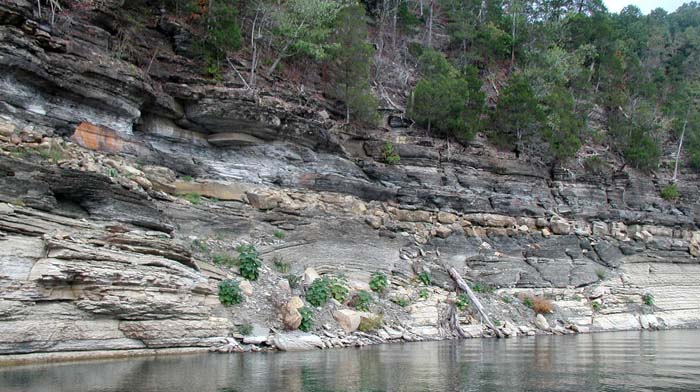
Figure 3. (A) Diagram of the eastern shore of Greasy Creek showing location of large scour fill based on a photomosaic.
Horizontal to vertical scale is approximately 2.5:1. There are several small scours with soft-sediment deformation structures (B)
and flow rolls, as well as a larger scour (C), which is filled with dark gray siltstone.
Lake level is 678.96 ft. From Greb and others (2008,, Fig. 8).

Figure 4. Model of lower Fort Payne deposition in the Lake Cumberland area.
No scale inferred. From Greb and others (2008, Fig. 28).
References
Continue to Harmon Creek Mount
Back to Fort Payne Formation Field Trip in the Lake Cumberland Region
Back to top of Geology of the Fort Payne Formation