Printable Maps

These maps are available for online viewing and download. They are also of high enough resolution for large format printing.
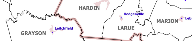
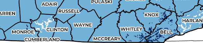
Counties and County Seats of Kentucky
This downloadable and high-resolution map (33" x 15" as printed) shows county names, county seats, time zones, and urbanized areas of Kentucky.
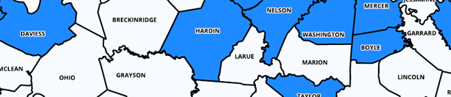
Kentucky Counties with Horticulture Agents
This downloadable and high-resolution map (17" x 11" as printed) shows county names while highlighting counties with Horticulture agents and their names. Updated June 2023!
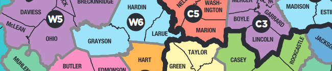
Cooperative Extension Service Regions and Areas of Kentucky
This downloadable map shows Cooperative Extension Service Regions and Areas of Kentucky.
Planting Region by County for Annual Crops
This downloadable and high-resolution map (17" x 11" as printed) shows the average last killing frost date and average length of growing seasons by county.
USDA Plant Hardiness Zones of Kentucky Updated November 2023!
This downloadable and high-resolution map shows the average extreme minimum temperature range using climate data from the previous 30 years and each range's designated USDA Plant Hardiness Zone. This map was updated using datasets from the Oregon State University PRISM Climate Group, November 2023.

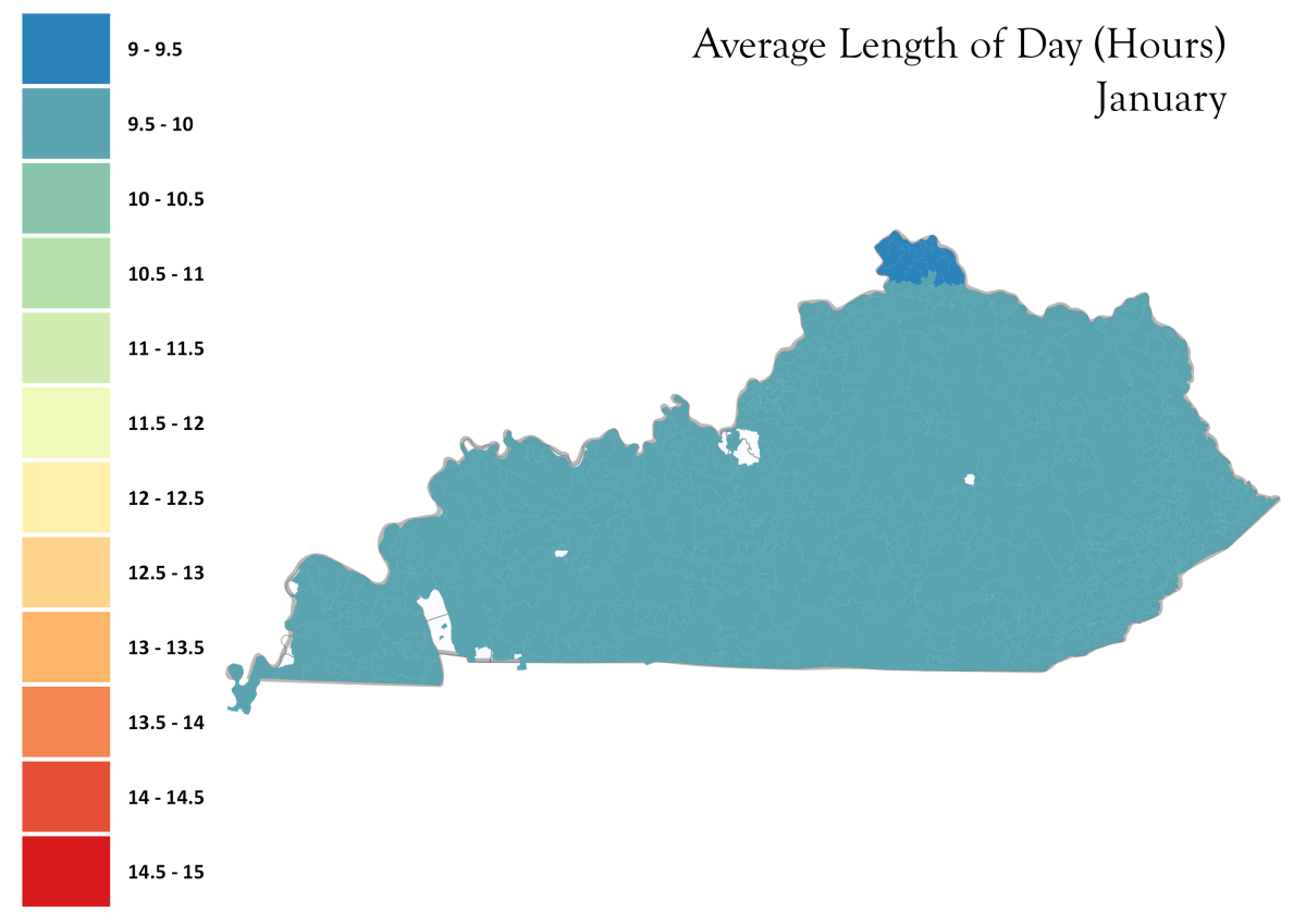
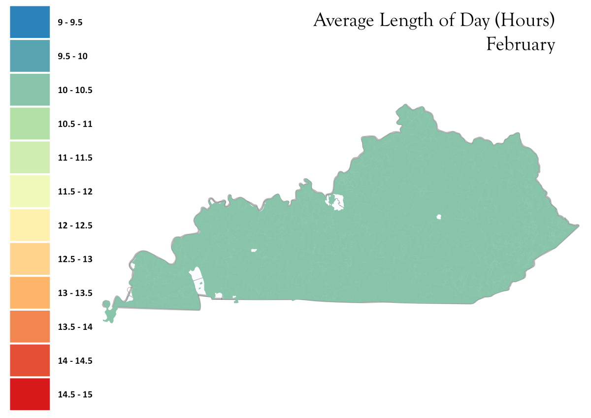
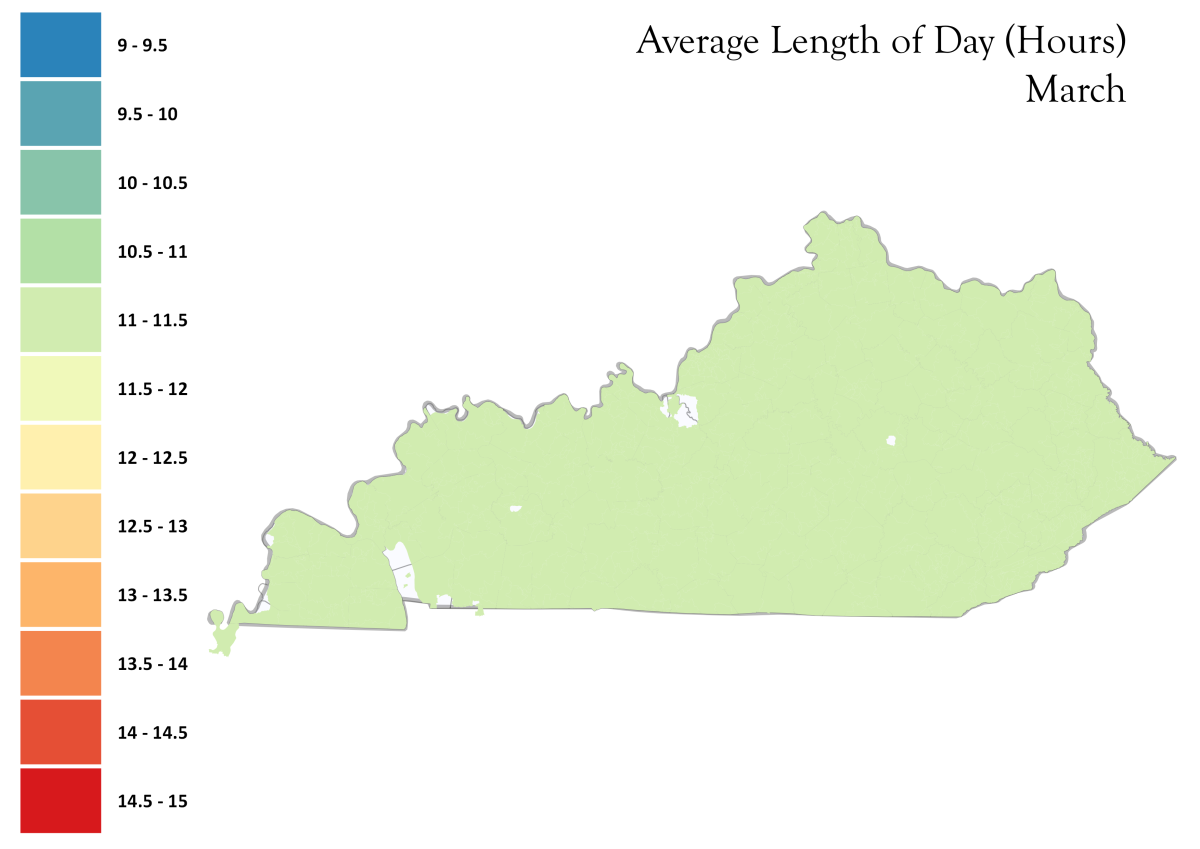
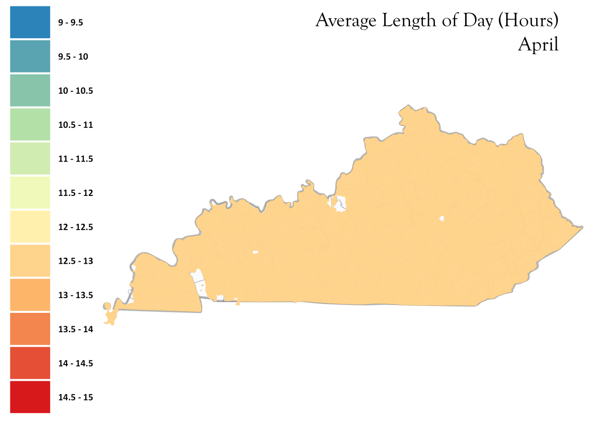
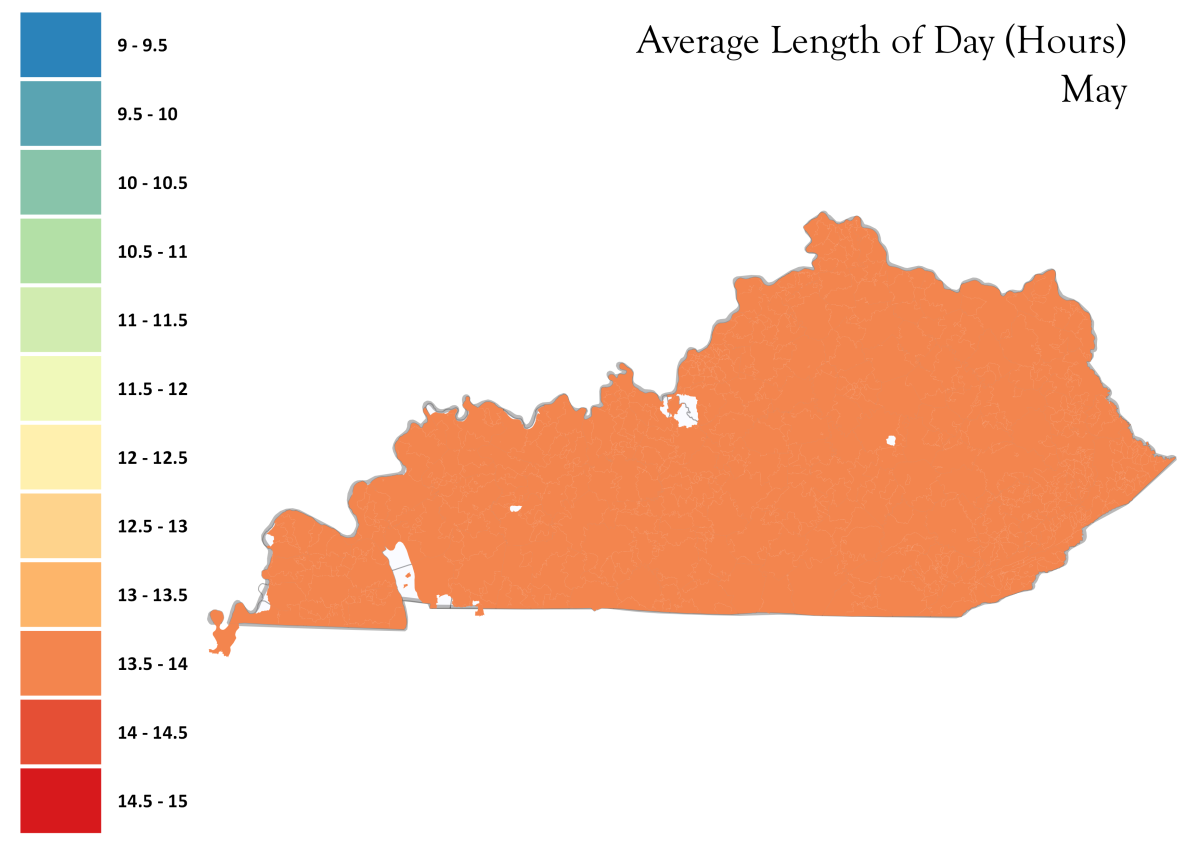
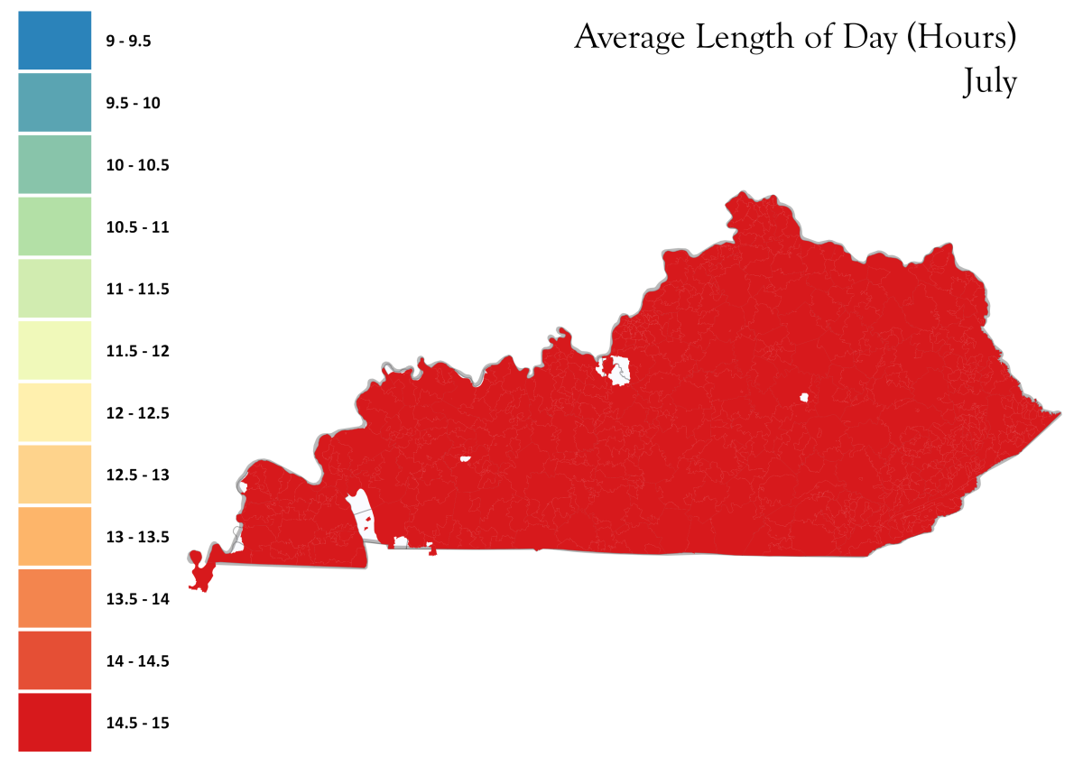
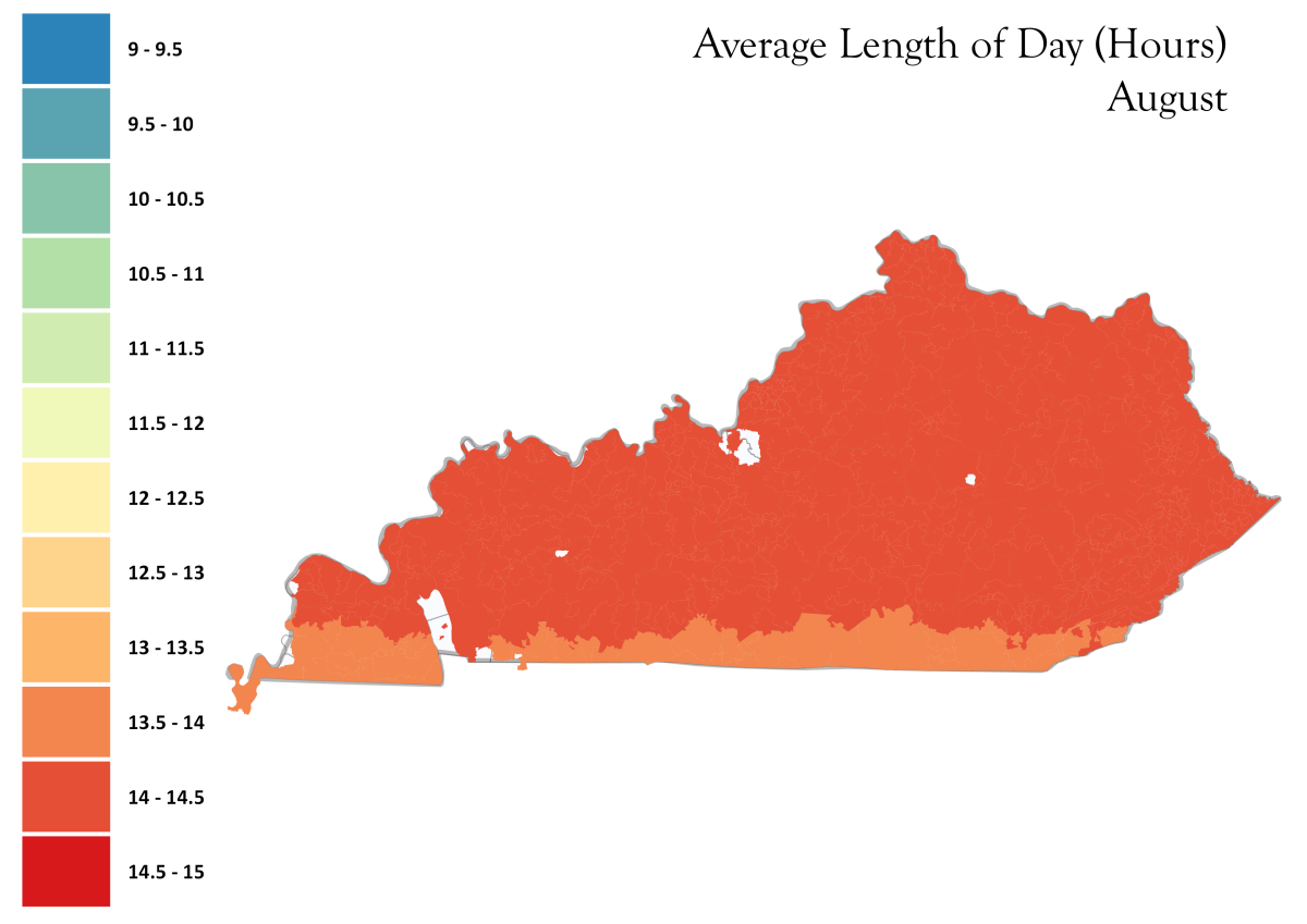
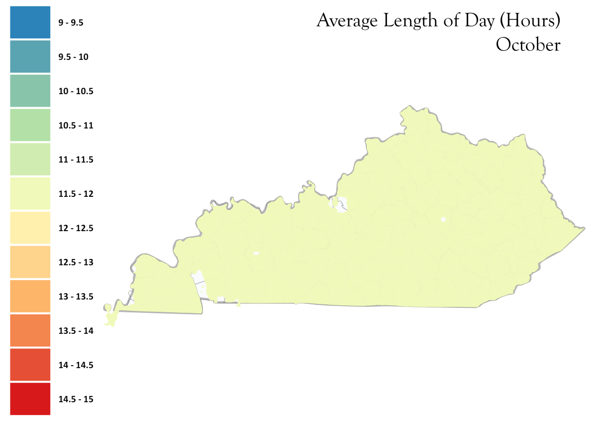
Average Day Length by Month
| January | February | March | April |
| May | June | July | August |
| September | October | November | December |
This set of downloadable and high resolution maps show the average day length for each month, categorized by color into 30 minute intervals. This can be helpful in Controlled Environment Horticulture and in planning plant production systems for plants sensitive to photoperiodism.
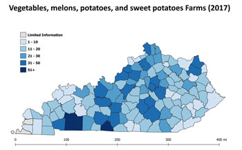
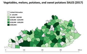
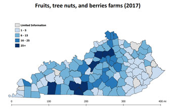
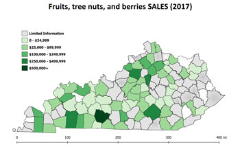
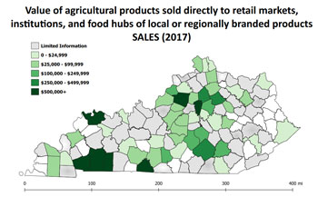
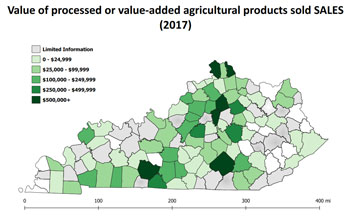
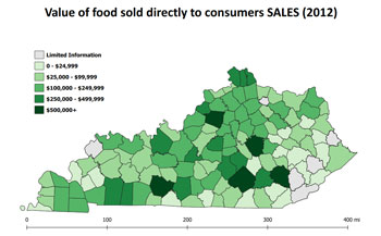
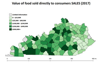
Local Food Census Maps
These high resolution, printable maps were developed in collaboration between the Center for Crop Diversification (CCD), the Kentucky Center for Agriculture and Rural Development (KCARD) and the Kentucky Horticulture Council (KHC) from USDA National Agriculture Statistics Service - Agricultural Census Data for the Local Food Promotion Program