
Maps
Explore the University’s Stormwater System
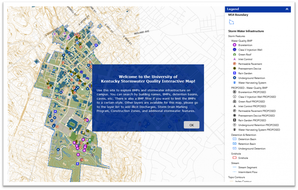 The University’s MS4 Permit requires the development of a comprehensive storm-sewer system map that shows the location of all major outfalls, the names and locations of all surface waters, the storm sewer system (all catch basins, pipes, ditches detention ponds, post-construction BMPs), and watersheds. The purpose of which is to aid in illicit discharge detection, tracking, and elimination.
The University’s Interactive MS4 Map provides this required information as well as illicit discharge locations, Storm Drain Assessment/Maintenance/Marking Program information, and Campus construction site locations. It also serves as a database for post-construction BMP information, Construction Stormwater Program site information, and illicit discharges.
Downloads
Available for download are static maps of the University’s MS4 system as well as Pervious vs Impervious Surface data.
 |
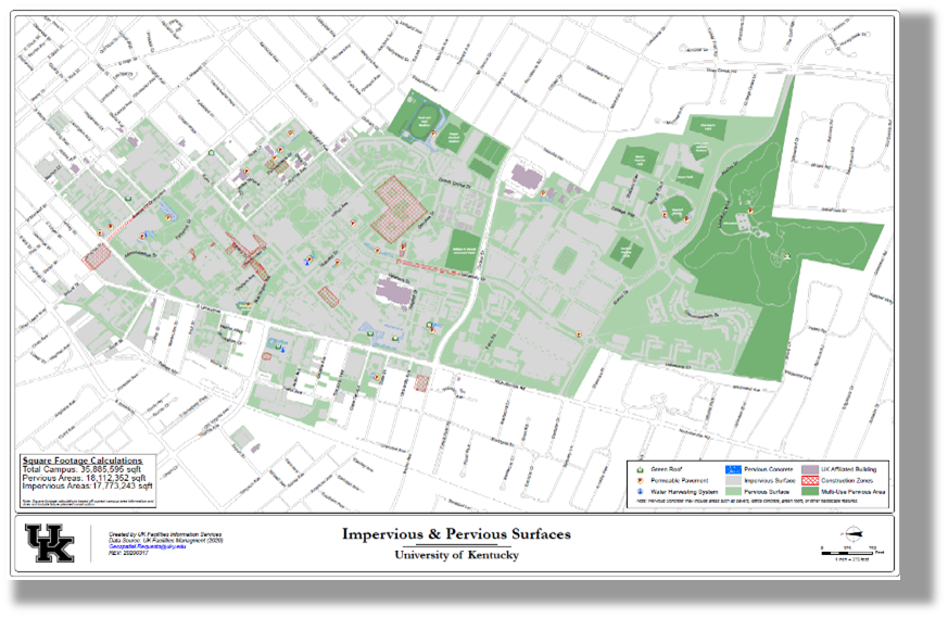 |
| MS4 Map | Pervious vs Impervious Surfaces Map |